While the snow threat for Monday has largely dried up, National Weather Service (NWS) forecasters are still tracking a period of wintry mix Monday night into Tuesday morning across much of the region.
The NWS says overrunning precipitation is expected to develop late Monday night as warmer air rides over shallow cold air near the surface. That setup could lead to light to moderate mixed precipitation, including freezing rain, during the overnight hours into early Tuesday.
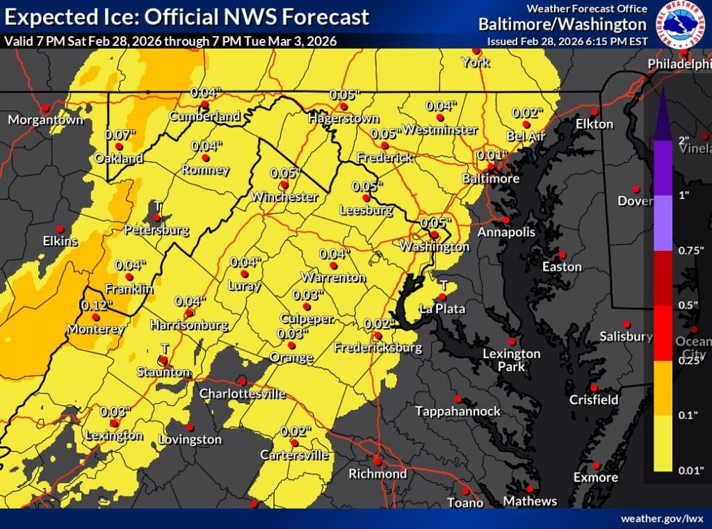
Current guidance suggests ice accumulations will generally remain light. Forecast ice amounts across the Baltimore-Washington region are mostly around a few hundredths of an inch, with slightly higher totals possible west of the metro area and at higher elevations. The primary concern would be minor icing on elevated surfaces such as trees, power lines, bridges, and untreated roads.
Forecasters note that the source of cold air is expected to retreat east fairly quickly, limiting the duration of any wintry precipitation. As warmer air continues to move in Tuesday, temperatures should rise above freezing and precipitation is expected to transition to plain rain by Tuesday afternoon.
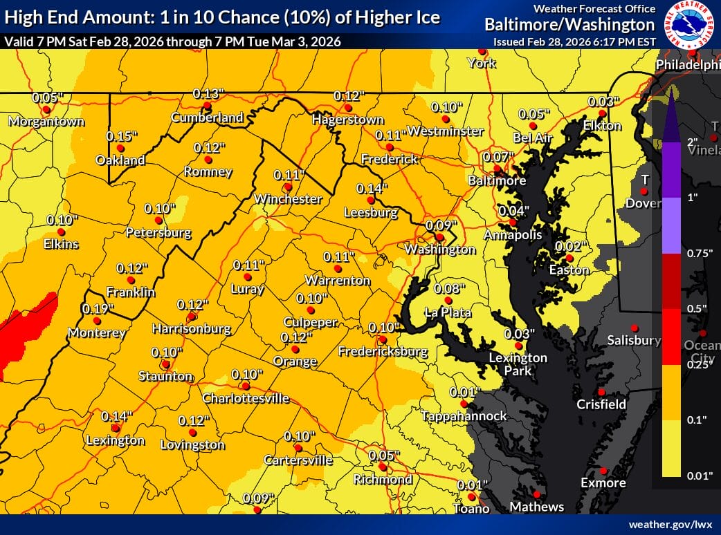
Even in a higher end scenario (map below), the chance of more impactful ice remains low, roughly a 1 in 10 probability. At this point, expected ice totals fall within winter weather advisory criteria, signaling nuisance level impacts rather than a significant ice storm.
Drivers should still be cautious during the Tuesday morning commute, especially in areas that tend to hold onto colder air longer. Conditions are expected to steadily improve as temperatures rise later in the day.