
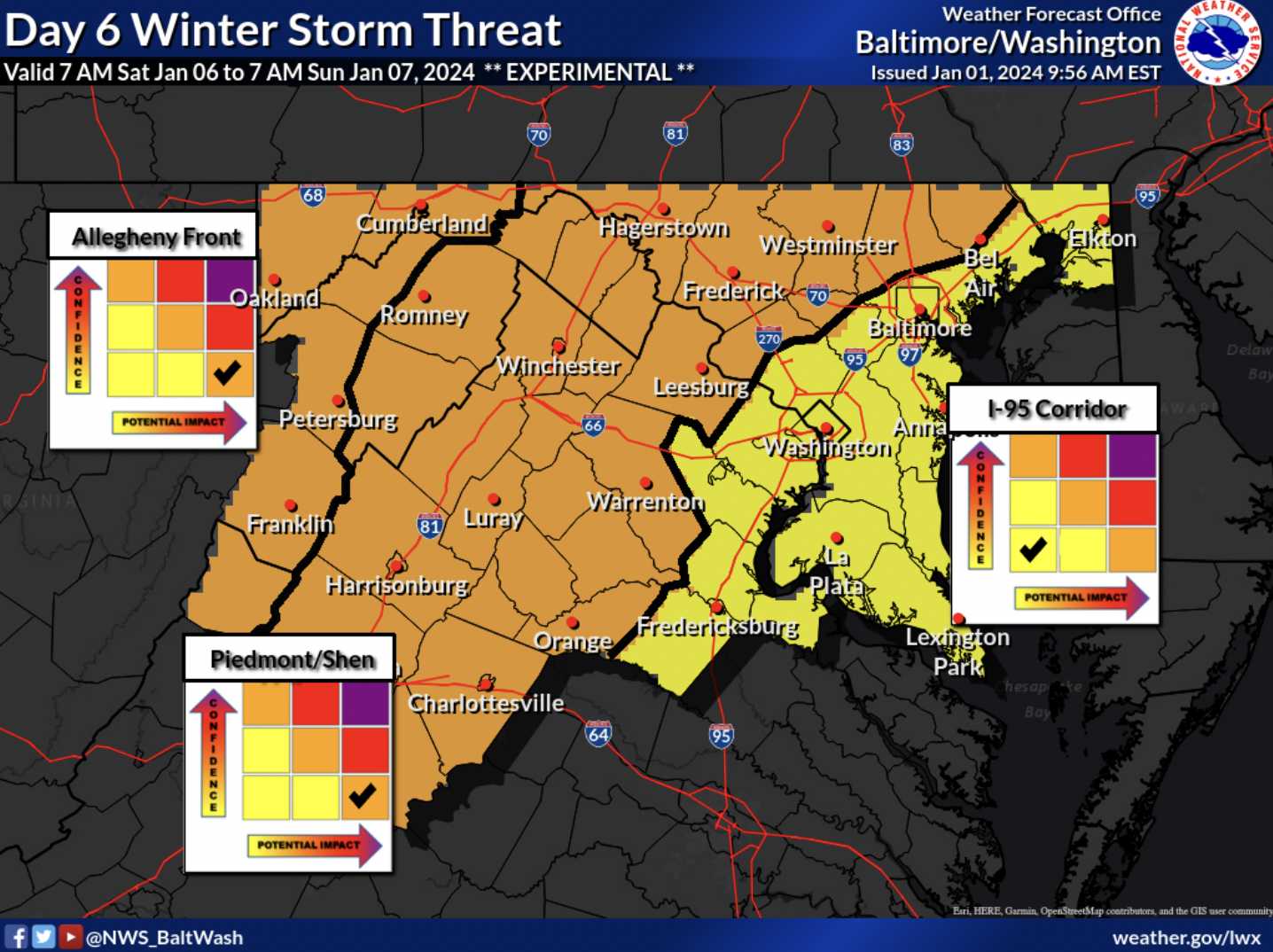
The National Weather Service (NWS) has increased chances of a storm to an “Enhanced Winter Storm Threat” for Sunday, January 7th for much of the DC Metro area, including half of Montgomery County, Loudoun County, half of Howard County, Frederick County and more. Per the NWS, this means “increased potential of more significant travel impacts and more closures.”
The rest of the DC Metro area is still in the “Slight Winter Storm Threat” category, which means “If threat materializes, may cause travel disruptions.” With something six days away, there is a lot of uncertainty. You may see maps shared with snowfall totals 10 inches+ or you may see some with the area barely missed by the storm. Either type can end up being correct, but none should be shared this far out…especially without a disclaimer emphasizing that a lot can change in the coming days.
Yesterday, we wrote about NBC4’s Doug Kammerer mentioning the potential for this storm when he stated that “You REALLY need to watch it.” The latest run of the GFS is great for snow lovers with the storm’s “bullseye” actually being a little bit further south (and west) than the DC Metro Area. That’s good news if you love snow, since often times these storms creep north as we get closer. So what can happen? Unfortunately, almost everything remains on the table. The storm could keep shifting and pretty much miss us, it can move a bit and leave us on the edge of the storm with a little bit of snow, it can be a couple inches with slop, or it can be a pretty solid hit with 6+ inches (or more). We will continue to watch this storm as we move closer throughout the week.