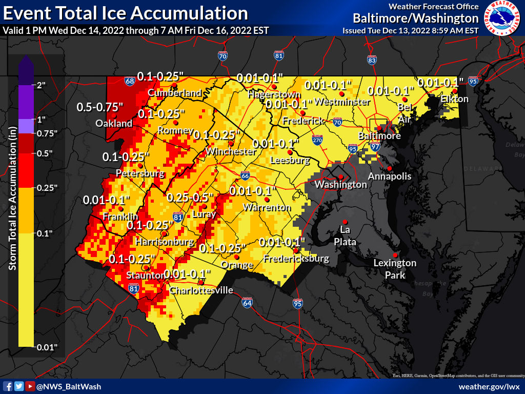
The National Weather Service has upped its projected ice totals for Thursday morning in the map it released earlier this afternoon (seen above in the featured photo). A little more than 1/3 of MoCo is now projected to get .1-.25” of ice with the other 2/3 or so at .01-.1”
In the “FutureCast” seen below, courtesy of Fox 5’s Mike Thomas, the freezing rain enters our area around 1am and continues to fall until turning to rain at approximately 8/8:30am in parts of the county and for almost all of the county by 9am. This is one of those situations where areas like Bethesda and Silver Spring see mostly wet roads, while areas further north like Gaithersburg, Germantown, Clarksburg, and Damascus see more significant issues involving ice.