After some back-and-forth in the forecast, the latest outlook suggests the more significant impacts from a potential early-week winter system may largely miss the region.
|
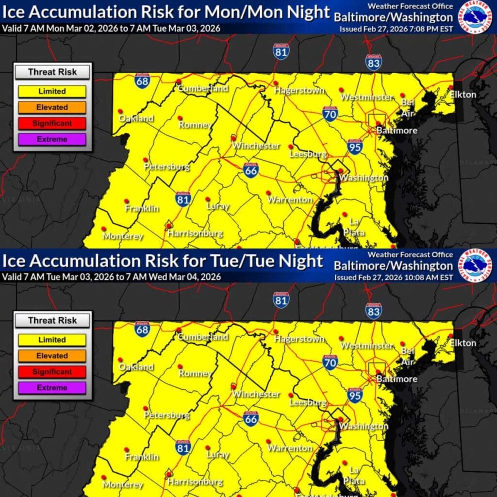

After some back-and-forth in the forecast, the latest outlook suggests the more significant impacts from a potential early-week winter system may largely miss the region.

An update from Del. Anne Kaiser indicates that legislation aimed at preventing an extension of the Montgomery County Public Schools calendar has cleared a major hurdle in Annapolis.
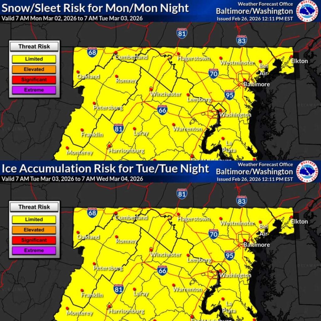
A developing weather pattern has the attention the National Weather Service, which noted a gradually increasing winter weather threat for Monday through Tuesday across much of the Baltimore-Washington region, including Montgomery County.

A Dense Fog Advisory is in effect this morning until 10am for most the of the DC Metro area, including all of Montgomery County.
Clouds will stick around after the fog this morning , but the sun should start peek through and temperatures will likely reach the mid 70s in the afternoon.

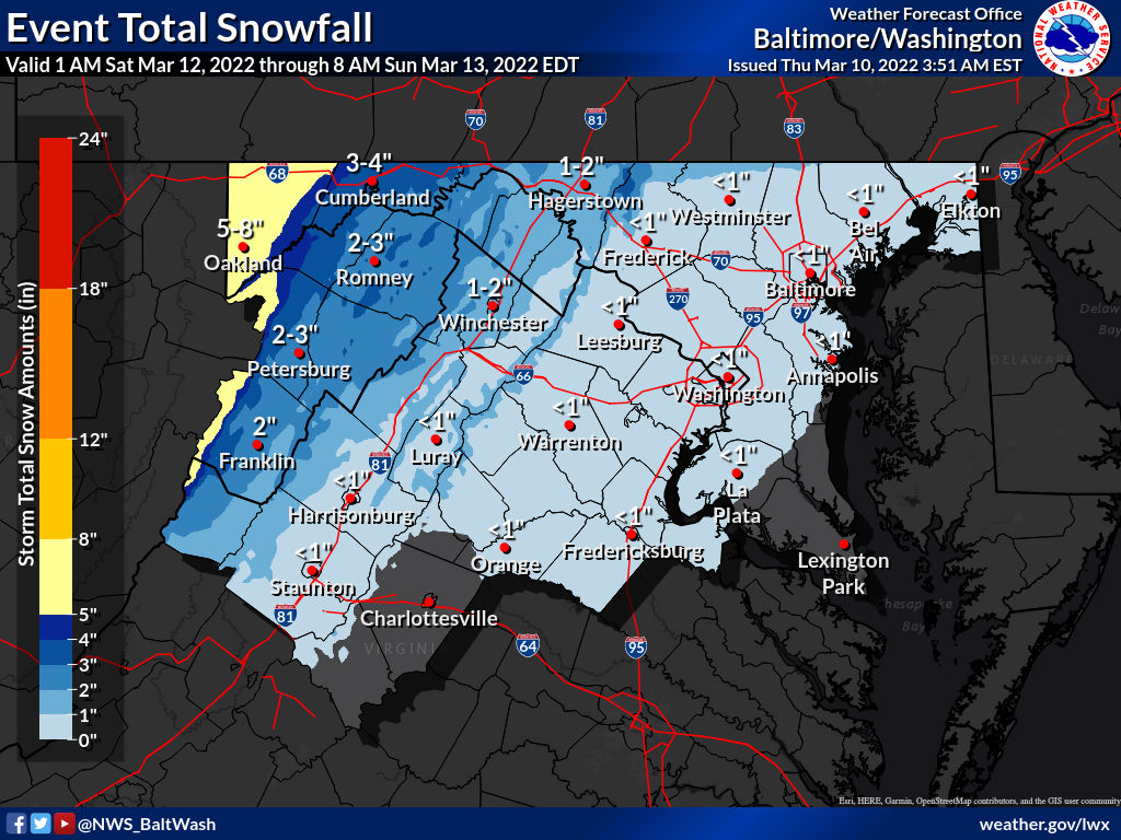
Snow totals are in from across the county after today’s snow storm that made things messy from the morning until the early afternoon across the area.
The forecast for this storm was fairly accurate, as expected snowfall for the area were between 2-5” depending on your location in the county

The National Weather Service has upgraded NW MoCo to a Winter Storm Warning from 6am until 3pm. C/SE MoCo remains under an advisory from 7am until 3pm.
Winter Storm Warning (NW MoCo)
A Winter Weather Advisory is now in effect for all of MoCo from 7am until 3pm on Saturday.
Per the National Weather Service:

A winter weather advisory has been issued for Northwest MoCo. This generally includes areas beginning at Germantown and points north/west (Clarksburg, Damascus, Poolesville, etc.).
Central/SE MoCo is not currently included in the advisory, as a little less precipitation is expected (see maps below). I fully expect all of MoCo and most of the DC Metro area to be included in the advisory later this morning.

This morning we let you know that a period of snow is possible on Saturday following rainfall early in the day. Temps will drop into the 30s on Saturday afternoon and eventually the upper 20s, which would allow for snow in the afternoon.
The evening update from the National Weather Service had almost all of MoCo in the 1 inch range with Damascus in the 1-2″ range.
This morning we let you know that a period of snow is possible on Saturday following rainfall early in the day. Temps will drop into the 30s on Saturday afternoon and eventually the 20s. If they drop soon enough, we’ll likely see the rain change to snow before the system heads out.
The latest update from the National Weather Service has almost all of MoCo in the 1 inch range with Damascus in the 1-2″ range. Below you’ll see the latest ‘Forecaster’s Discussion’ per the NWS:
Temperatures are expected to reach the low 50s today, but before we get there we’ll have to deal with some patchy fog and cold temperatures this morning that could cause a few slick spots. Below you”ll see an update from the National Weather Service:
Patches of dense fog has developed east of the Blue Ridge Mountains early this morning. With temperatures near or below freezing, there may be a few slippery spots during this time. Reduce speed and leave extra travel time and following distance. Be alert for slippery spots, and avoid braking or turning suddenly.