
A developing weather pattern has the attention the National Weather Service, which noted a gradually increasing winter weather threat for Monday through Tuesday across much of the Baltimore-Washington region, including Montgomery County.
According to the National Weather Service’s latest forecaster’s discussion, a cold front is expected to move through the region late this weekend. Behind it, high pressure passing north of the eastern Great Lakes is forecast to usher in colder air, with temperatures dropping into the upper 20s to mid-30s on Monday. That narrow temperature range is a key reason forecasters say uncertainty remains high.
Once the front stalls to the south, zonal flow aloft could allow multiple shortwave systems to move through the region between Monday and early Wednesday. Current model guidance, including the GFS, ECMWF, and ICON, is showing the potential for snow, sleet, and freezing rain, though the exact placement and intensity of impacts are still unclear.
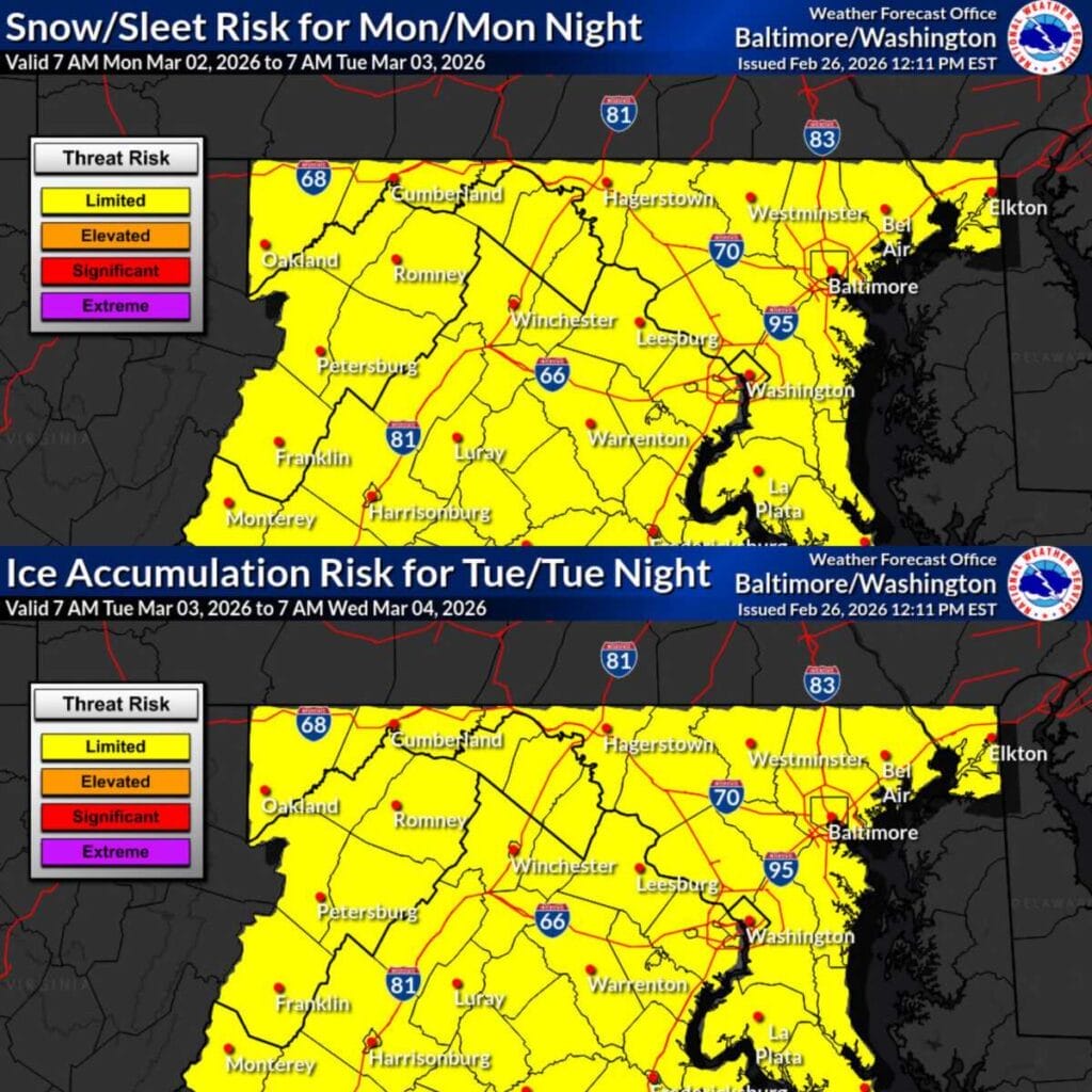
The National Weather Service maps currently show a limited risk for snow and sleet on Monday into Monday night, followed by a limited risk for ice accumulation on Tuesday into Tuesday night. While “limited” does not imply a major storm, it does suggest the potential for slick roads, spotty travel issues, and localized impacts, especially if temperatures hover near freezing.
The NWS emphasized that the position of the surface high to the north will play a major role in determining whether the region sees wintry precipitation or simply cold rain. Small shifts in that setup could significantly change outcomes, both in terms of precipitation type and accumulation.
At this point, residents are encouraged to stay aware and monitor updates, particularly those with travel plans early next week. More clarity is expected as the event gets closer and confidence in the temperature and track details improves.
