MoCoSnow

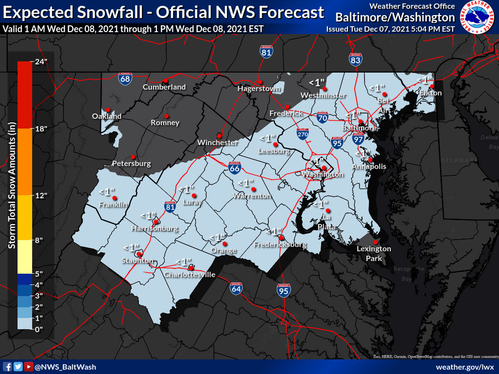
8:51am Update: A Winter Storm Watch has now been issued for Montgomery County with 1-3 inches of snow expected.

Previous update below:Per the National Weather Service, a low pressure system has trended north and west over the last 24 hours, which will now bring the potential for heavy snowfall just south of Montgomery County late tonight into Monday morning.


MoCoSnow

The threat we’ve been watching has almost completely backed off, with very little to no snow expected to fall Wednesday morning.

Per the National Weather Service, less than an inch is expected to fall, with the “high end” amount under an inch as well (10% chance of the high end amount falling).


MoCoSnow

At 7:35pm, the National Weather Service provided its latest thinking on the potential winter storm set to arrive late Tuesday (December 7th) into Wednesday (December 8th).

“Here’s our latest thinking on the system set to arrive late Tue into Wed. Check out forecast amounts and the higher end potential. Keep in mind, Mon will be warm but it will be short lived as a strong cold front moves through bringing 30-40 mph wind gusts.”


MoCoSnow

We’re about a month away from winter and the colder weather is starting to catch up. This week will start off with below average temperatures with today coming in close to average as highs will be near 50°. Rain is possible early on, but things will clear up in the afternoon.

Tuesday and Wednesday will be colder with temps in the mid 40s, but Thanksgiving day will bring above average temperatures with highs in the upper 50s.


View More Stories