A Winter Weather Advisory is in effect from 6am until noon on Sunday morning.
Temperatures will likely remain below freezing h til the late morning, which could cause for some slick spots in MoCo until about noon.

A Winter Weather Advisory is in effect from 6am until noon on Sunday morning.
Temperatures will likely remain below freezing h til the late morning, which could cause for some slick spots in MoCo until about noon.
A Winter Weather Advisory is in effect from 6am until noon on Sunday morning.
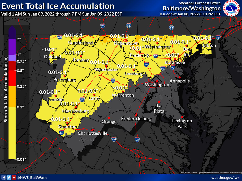
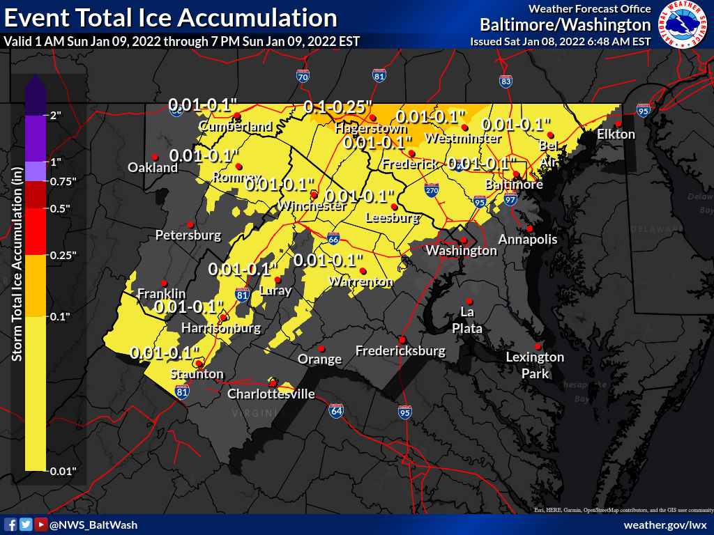
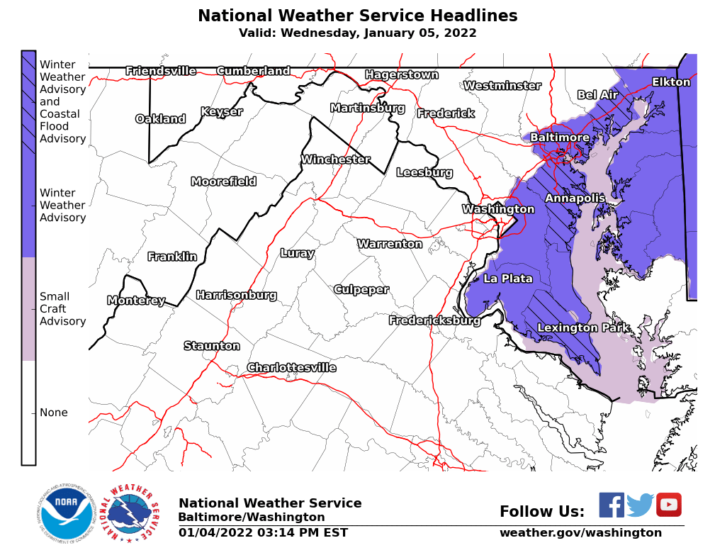
Per the National Weather Service:

Below you’ll see some preliminary snowfall reports, per the National Weather Service. Leading the way are areas like Olney, Damascus, Poolesville, and Clarksburg with over 5 inches (note: not every area in MoCo is listed):

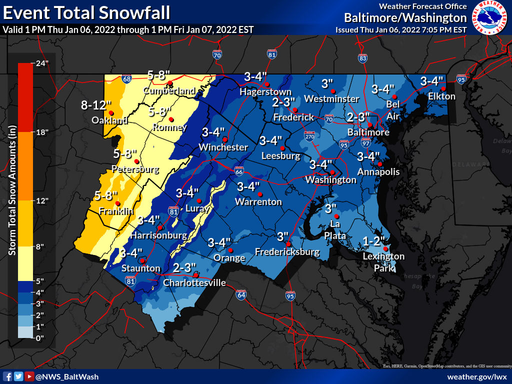
The National Weather Service made additional changes to the snow maps after 10pm tonight.
As you can see above, totals are slightly higher than a few hours ago. 3-4 inches now expected for all of MoCo with the reasonable worst case scenario map st 5-8 inches.
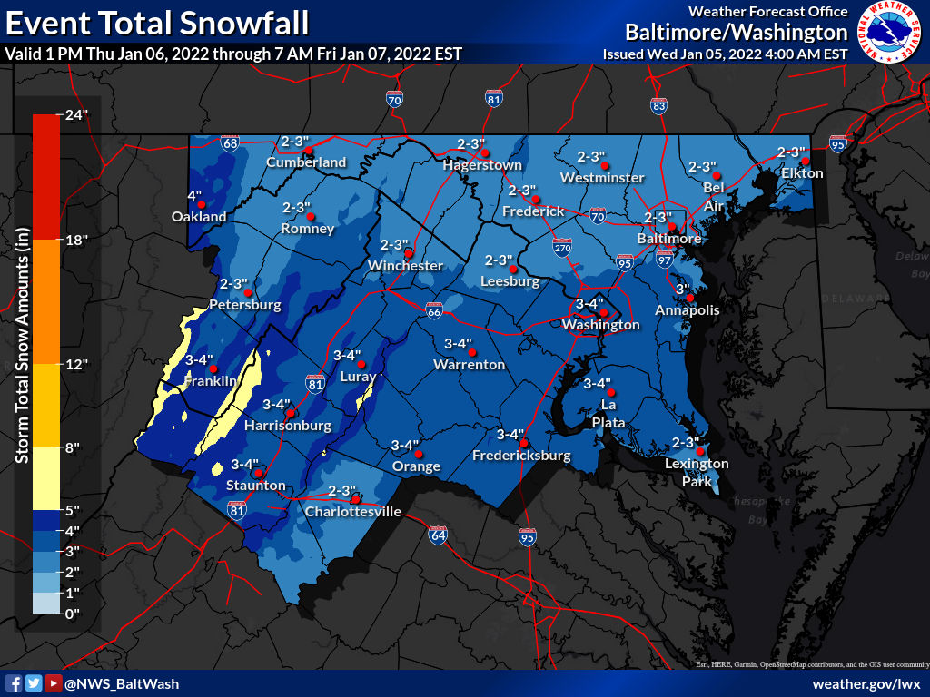
The National Weather Service has made some last minute updates and has put out new maps for the storm expected to arrive in a couple hours.
In the latest updates you’ll see the top third and bottom third of MoCo in the 3-4” range with central MoCo in the 2-3” range.

A Winter Weather Advisory remains in effect, and has been extended to last from 9pm tonight until 7am tomorrow morning, for a fast-moving system that’ll likely bring us some snow early Friday morning.
Latest guidance is showing a little less snow coming our way than what we saw coming last night and early this morning

The National Weather Service released its latest expected snowfall maps this morning with all of MoCo coming in on the 3-4” range.
In the images you’ll also see a “reasonable worst case scenario” map showing a possible 6-7” if there’s a boom scenario and a “low end amount” map that shows just over an inch area-wide.
The National Weather Service has released a map for the potential of snow on Thursday night into Friday morning.
Per the map, 2-3” of snow is expected for central and upper MoCo while 3-4” is expected for southern MoCo (Bethesda/Silver Spring).
A Winter Weather Advisory has been issued for areas near/east of the I-95 corridor for possible freezing rain between 4am and 9am tomorrow.
As of now, none of MoCo is under this advisory, but all of neighboring Prince George’s County is. A Special Weather Statement has been issued for MoCo.
The National Weather Service provided a pretty good snow forecast for this morning’s storm, with most places very close to what was being projected for them.
Leading the way for MoCo was Somerset, an area near Bethesda that borders DC, with 8.5 inches. Areas in S/SE MoCo generally came in with the highest numbers, while northern areas that usually get the most snow came in with lower totals.

Montgomery County has activated the Extreme Cold Plan for a Hypothermia Alert for 6pm Sun, 12/19 until 11am Mon, 12/20.
Expect the wind chill to be below 32 deg. Wear layers if you go outside. Take extra precautions if you spend significant time outdoors.