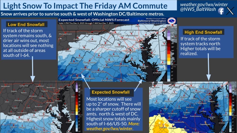
The National Weather Service (NWS) has issued a Winter Weather Advisory for much of the region, including the District of Columbia, Prince George’s County, Anne Arundel County, Montgomery County, Fairfax County, and Arlington/Falls Church/Alexandria. The advisory is in effect from 4 a.m. to 4 p.m. Friday, with forecasters warning of treacherous travel conditions during the morning commute.
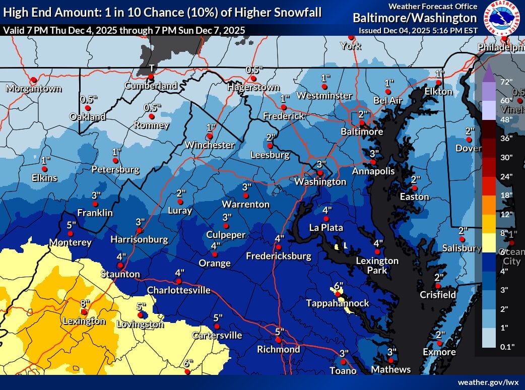
According to the NWS, “A combination of light snow and very cold temperatures will result in treacherous travel Friday morning. The morning commute will be impacted, with slick and icy roads and sidewalks expected.” Snowfall totals are expected to be around one inch, though slightly higher amounts are possible in any localized banding.
Temperatures will remain in the 20s during the onset of precipitation, increasing the likelihood of snow accumulating on all untreated surfaces, including roads, sidewalks, and parking lots. As the system exits, forecasters note that “a light freezing drizzle is possible into Friday afternoon,” which may prolong slippery conditions.
In its afternoon forecast discussion, NWS noted that confidence remains low in how far north the accumulating snow will reach. However, the latest model guidance has trended slightly farther north and faster with the system compared to earlier runs.
“Ensemble members are more tightly clustered with the northern edge of the snow, but there is still some room for error,” the forecasters wrote. Certainty is highest along the I-64 corridor, lower near US-50/I-66, and lowest toward the I-70 region. Areas near or north of I-66 and US-50 may end up with little to no snow if the northern edge remains tight.
The latest HRRR model, now fully within range of the event, is showing slightly more precipitation pushing into central Maryland than earlier solutions suggested. Because of the timing of the precipitation, beginning early Friday morning, combined with the very cold temperatures, a delay announcement Thursday night would give families more time to plan without scrambling in the morning. A delay would also allow MCPS and other local systems to reassess conditions once the bulk of the snow has ended.
If totals remain around a half inch and end by late morning, a delayed opening may be sufficient. If accumulations trend closer to one to two inches, closure becomes more likely.
Pencil Prediction: 3 pencils ✏️✏️✏️
View this post on Instagram