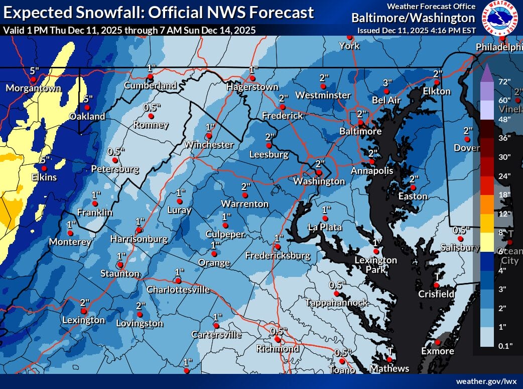
The National Weather Service is tracking a system that could bring accumulating snow to the region early Sunday morning, with most of Maryland and Northern Virginia currently forecast to receive around 2 inches. Updated snowfall projections show a wide range of possibilities depending on how quickly temperatures drop and how the heaviest band sets up.
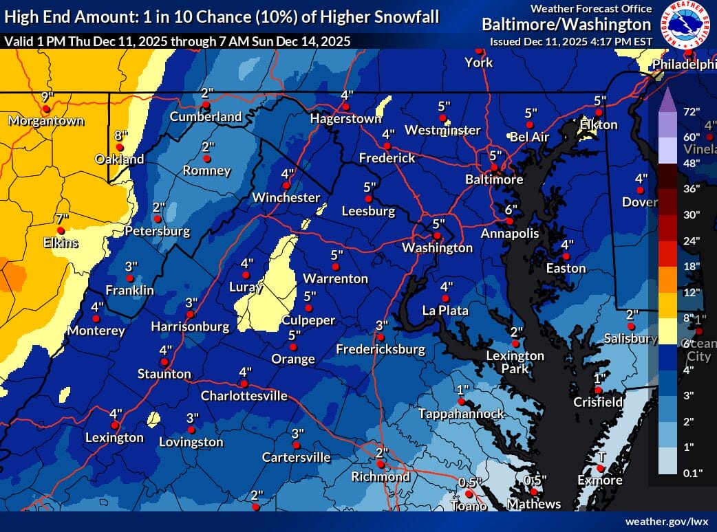
Official NWS guidance shows a “high end amount” of 5 inches for much of the area, representing a 10 percent chance of higher snowfall totals. That scenario requires colder air to win out and the main precipitation band to remain overhead long enough for steadier snow.
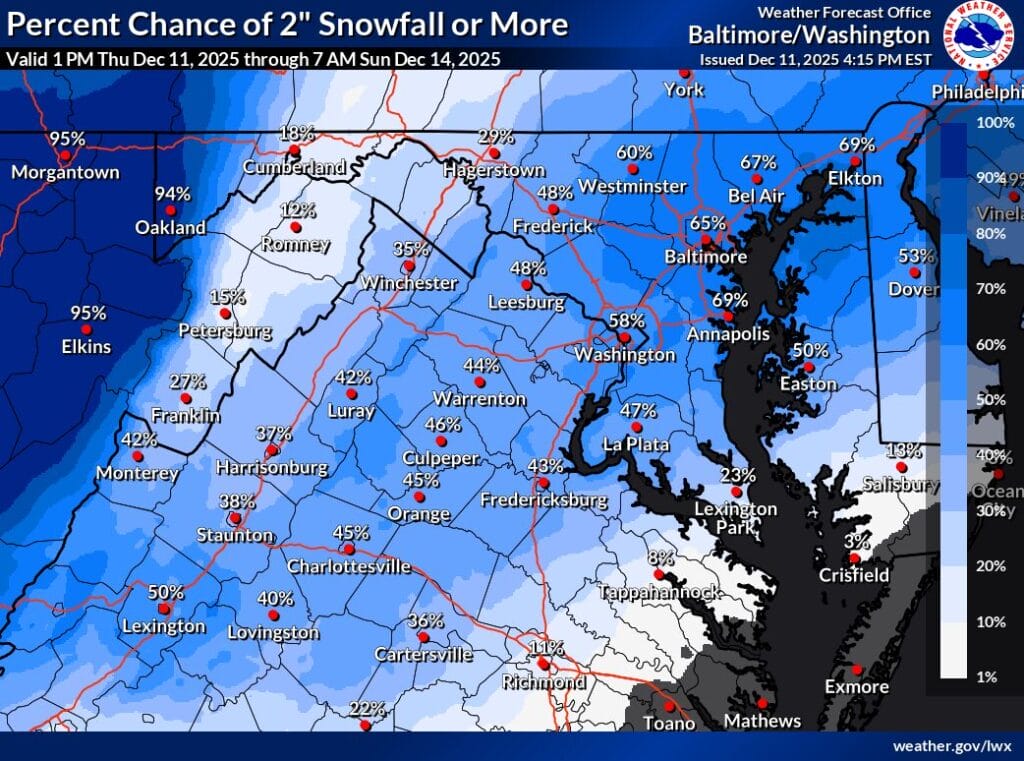
In its afternoon forecast discussion, the NWS highlighted the continued uncertainty along and east of I-95. Forecasters note that this is the area with the biggest spread in potential outcomes. Per the NWS:
“Further east, around the I-95 corridor, the widest range of potential solutions exists. If most of the precipitation were to fall as rain, or the band of higher QPF were to shift northward out of the area, as little as a coating to an inch of snow could occur. Currently, we have 1 to 4 inches of snow forecast as the most likely scenario to the east of the Blue Ridge. In a high end scenario, as much as 6 inches of snow could occur under the heaviest part of the band if the precipitation stays all snow.”
The images from the NWS Baltimore/Washington office illustrate three different angles of the forecast: expected snowfall (most likely), high end potential, and the probability of two inches or more. Large portions of central Maryland show a 50 to 70 percent chance of reaching at least two inches, including Montgomery, Howard, Frederick and Baltimore counties.
The timing favors a Sunday morning impact, with the steadiest precipitation expected in the AM. We will continue to monitor and follow updates from the National Weather Service and local meteorologists as the system approaches.