A potential winter storm could impact parts of the DMV (DC, Maryland, and Virginia) on Friday, with the greatest risk for wintry precipitation focused north of I-66 and U.S. 50, including portions of Montgomery County, according to the latest model guidance and National Weather Service discussions.
FOX 5 meteorologist Mike Thomas shared the Tuesday night run of the European model, noting that if current timing holds, the bulk of travel issues would occur Friday afternoon and evening. Temperature profiles suggest a messy setup, with a mix of sleet and freezing rain possible across much of the region, especially farther north, while more substantial snow totals remain possible in parts of Pennsylvania and New York.
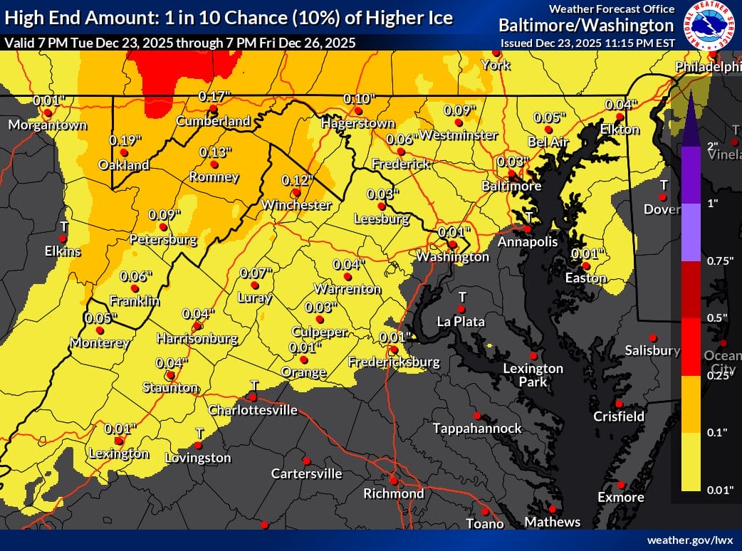
National Weather Service forecasters say models continue to advertise the potential for a winter storm on Friday, particularly for areas north of I-66/U.S. 50. Most guidance favors a corridor from around I-70 northward, extending across the Mason-Dixon Line into Pennsylvania. The overall pattern is favorable for a wintry mix dominated by freezing rain and sleet, driven by classic cold-air damming. Canadian high pressure building over Quebec is expected to lock colder air near the surface, while warmer air moves in aloft, creating conditions that support icing.
For northern Maryland, including areas near and north of Frederick and toward the Pennsylvania line, models are also hinting at the potential for some snow due to colder atmospheric profiles. Even small ice accumulations can cause significant travel problems, and forecasters caution that residents and holiday travelers should factor this potential storm into their Friday plans.
Aside from precipitation, it will be a chilly day across the region, with highs generally in the 30s to low 40s, and 40s closer to the Alleghenies. Friday night, the focus for wintry precipitation is expected to shift toward northeastern Maryland before transitioning to a cold rain as slightly milder air moves in. Overnight lows are forecast to range from the upper 20s to the 30s.