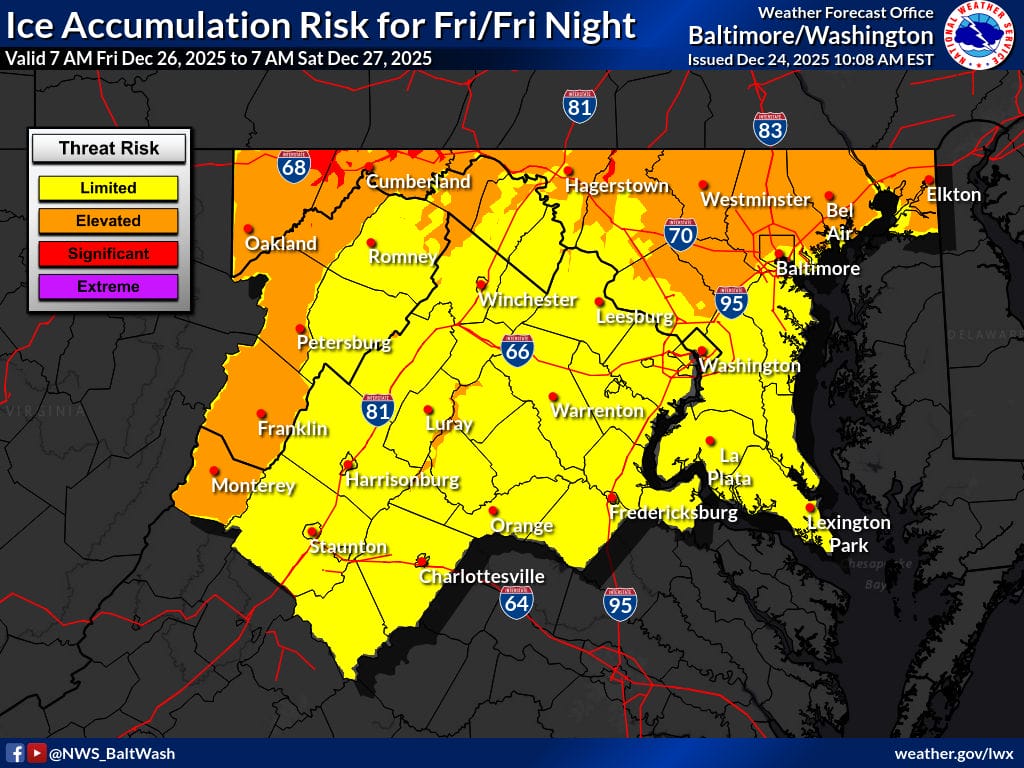
A period of potentially impactful winter weather is expected across much of Maryland, Washington, D.C., and northern Virginia from Friday afternoon through Friday night, with freezing rain and sleet posing the greatest concern.
According to the National Weather Service (NWS), a shortwave trough and surface low will approach from the northwest on Friday, with the most widespread precipitation expected Friday afternoon and evening. Cold and dry surface conditions already in place will set up an ideal cold air damming scenario, increasing the risk for ice accumulation, especially north and west of the metro areas.
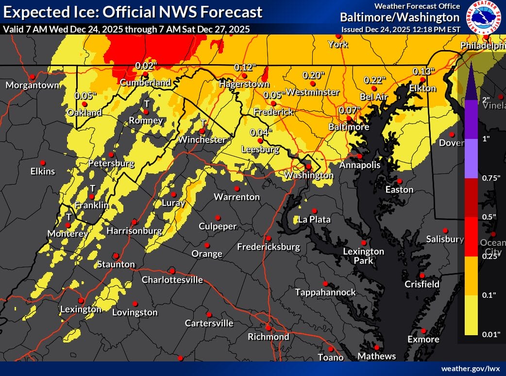
Forecast guidance shows freezing rain and sleet as the dominant precipitation types across much of the region. While some snow is possible near and northeast of Baltimore, warmer air aloft is expected to limit snow potential and favor ice instead. Areas where surface temperatures rise above freezing could see periods of plain rain.
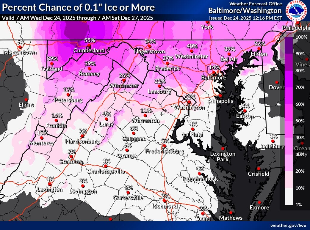
Ice risk extends eastward through northern Maryland, including areas near Hagerstown, Westminster, and portions of northern Baltimore County. NWS probability maps show a moderate chance of at least one tenth of an inch of ice in these areas, with lower but still notable chances farther south toward the I-70 and I-95 corridors, including Montgomery County.
Closer to Washington DC, and south toward I-66 and US-50, wintry impacts are expected to be more limited. Warmer surface temperatures and lighter precipitation amounts should reduce ice accumulation, though slick spots remain possible if temperatures hover near freezing. Forecast confidence decreases farther south, where small temperature changes could significantly alter impacts.
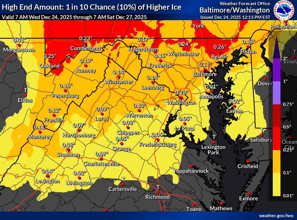
Another uncertainty involves the balance between sleet and freezing rain. More sleet would reduce ice accretion, while prolonged freezing rain could worsen conditions. Forecasters also note the potential for nondiurnal temperature trends Friday night, meaning some areas could briefly warm overnight as the system shifts offshore.
Residents are encouraged to closely monitor forecasts, especially in northern and western parts of the region, where even small changes in temperature could significantly affect ice totals. Travel conditions could deteriorate quickly Friday afternoon and evening, particularly on untreated roads, bridges, and elevated surfaces. The NWS emphasizes that forecast details may continue to shift as newer data becomes available.