The National Weather Service has issued a Winter Storm Warning from 11pm Saturday through 4am Monday. Forecasters say a combination of heavy snow, sleet, freezing rain, and bitter cold will create dangerous conditions that could linger well into next week.
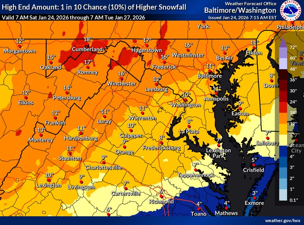
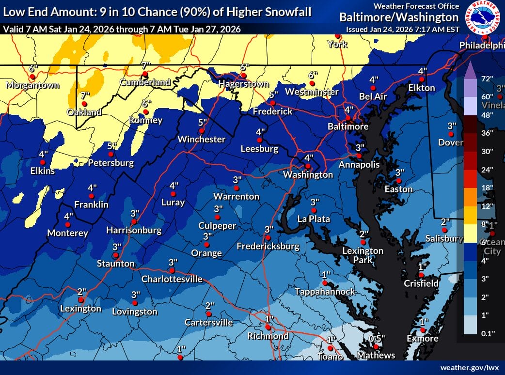
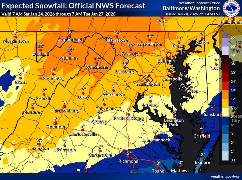
The latest official snowfall forecast from the NWS shows a sharp gradient across the region. Areas closer to Washington, including Bethesda and Silver Spring, are projected to receive around 8 inches of snow, while locations farther north and west, including Damascus and areas closer to Frederick, are forecast closer to 13 inches. The higher end snowfall scenario (map below) shows a 10 percent chance of 10 to 16 inches across much of the area, while the low end scenario (map below) suggests 4 to 6 inches regionwide.
Snow is expected to overspread the region late Saturday night and become heavy at times overnight, with snowfall rates potentially reaching one to two inches per hour. All areas are expected to start as snow for the first several hours before mixing becomes a factor early Sunday morning. Forecasters expect sleet to mix in first across Virginia and the Shenandoah Valley between then spread northward toward the DC metro area between later in the morning. Freezing rain is expected to develop later Sunday, especially south of Highway 50, and may reach major corridors including I-66, Route 7, and I-95 by Sunday afternoon.
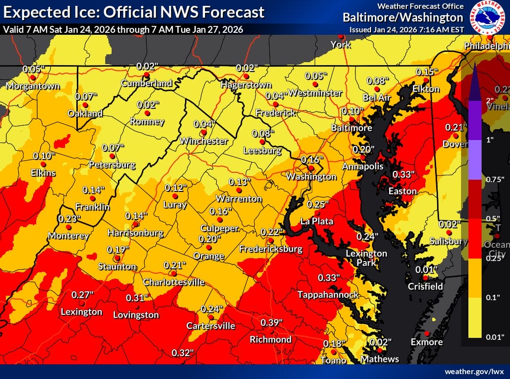
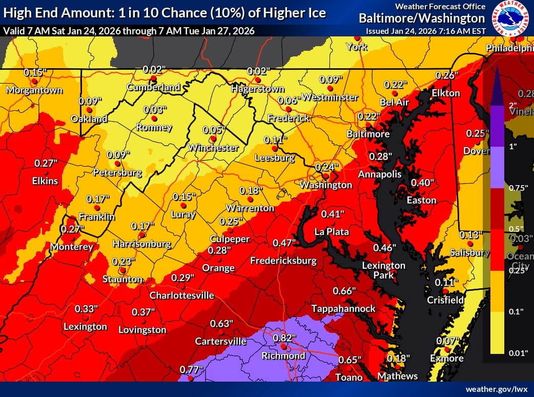
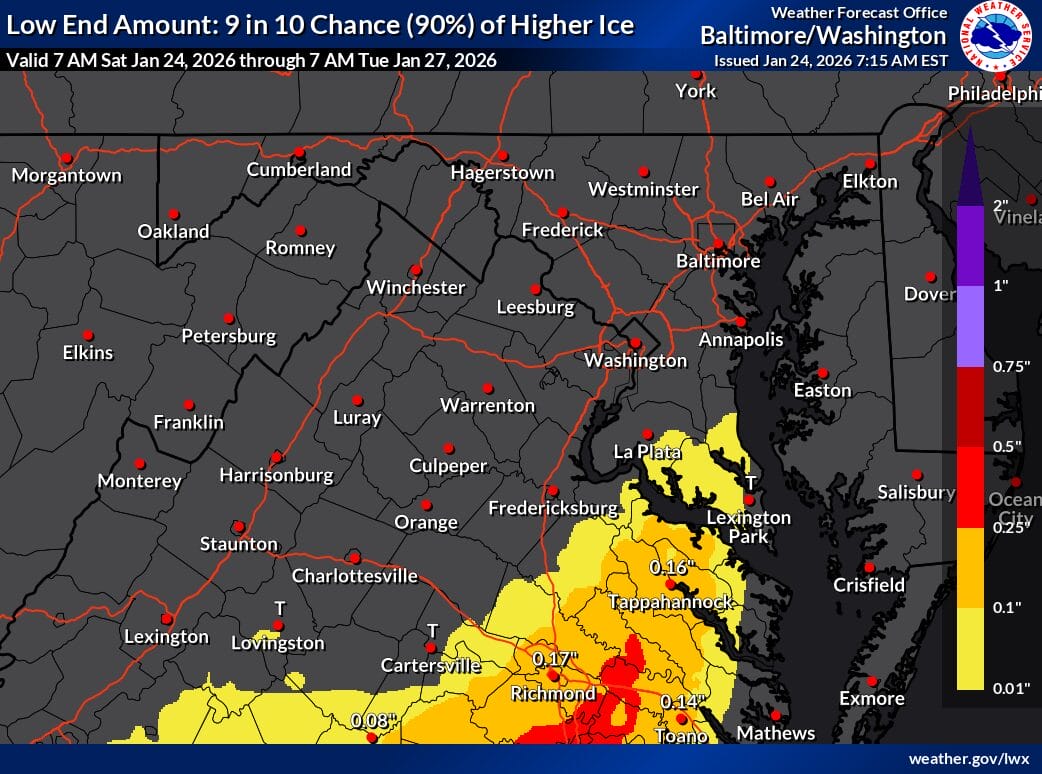
Ice accumulation is a significant concern. Forecasts show about 0.16 inches of ice closer to DC and roughly 0.04 inches farther north. In a worst case scenario, the high end ice forecast shows close to a quarter inch of ice near the District and about a tenth of an inch in northern Montgomery County. While the low end scenario shows little to no ice, forecasters stress that even modest icing could lead to tree damage and power outages, especially when combined with heavy snow.
The National Weather Service says impacts could be severe. Travel may become nearly impossible at times, visibility could drop to a quarter mile or less during heavier precipitation, and hazardous conditions could significantly affect the Monday morning commute. Very cold temperatures and wind chills in the teens and single digits will persist through the weekend and into next week, with sub zero wind chills possible at times. Any snow or ice that falls is expected to remain on the ground, with quick refreezing likely even on days with sunshine.
View this post on Instagram