
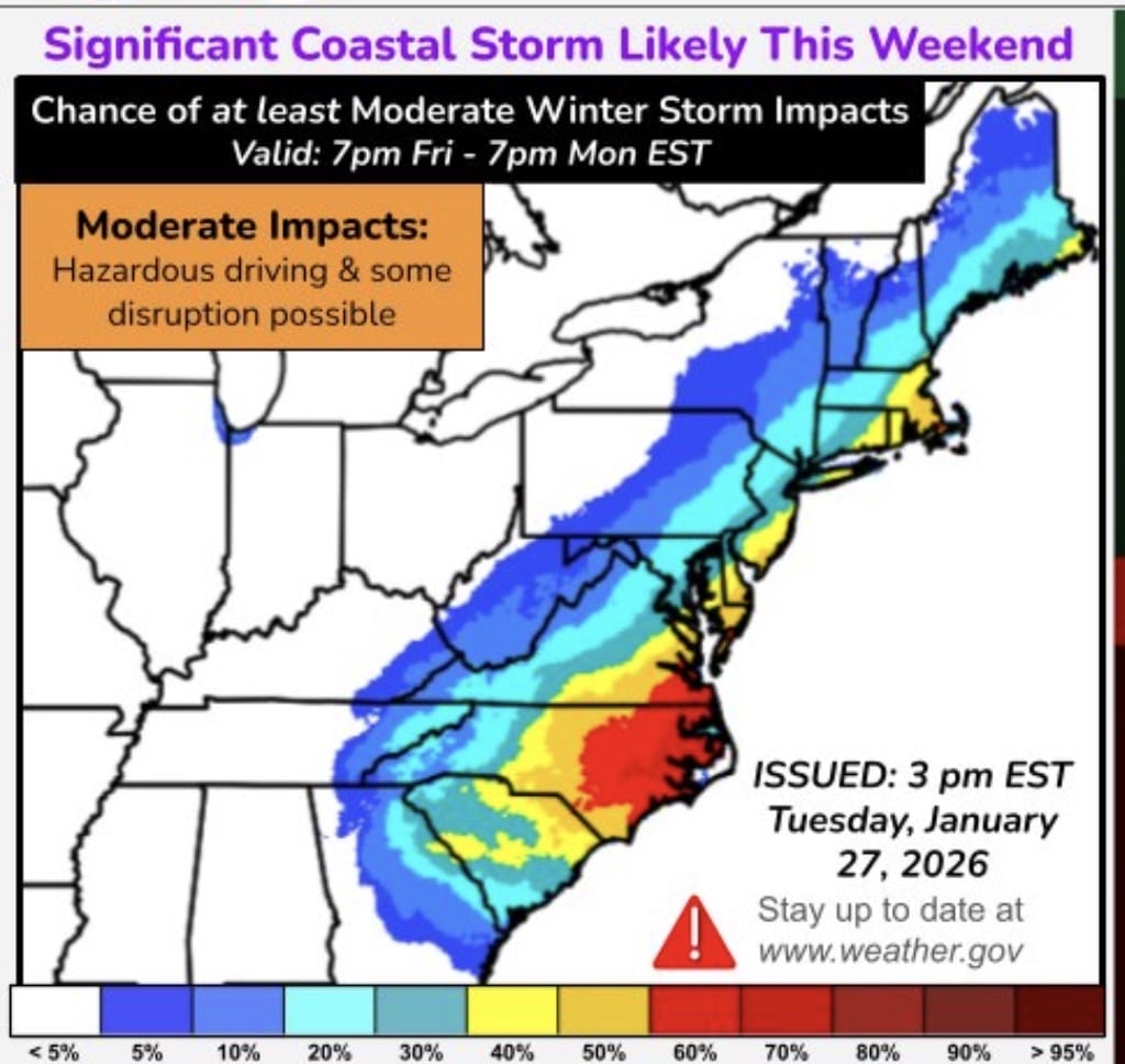
The National Weather Service is closely monitoring the potential for a significant coastal storm this weekend, though confidence remains low on whether it will meaningfully impact central Maryland.
In a recently released graphic, the NWS shows the greatest potential impacts focused on Maryland’s Eastern Shore. Central Maryland, including Montgomery, Frederick, Howard, and Baltimore counties, currently sits in a zone with about a 20 percent chance of moderate impacts.
Just a couple of nights ago, forecast models suggested the storm could take a much closer track to the coast, a setup that would have allowed heavy snow to blanket much of the region. Since then, newer model runs have largely pushed the system farther east into the Atlantic. That shift has significantly reduced the likelihood of a major event for the DC metro area, at least for now.
On Tuesday, WUSA9 meteorologist Kaitlyn McGrath highlighted the growing split among the major weather models. The GFS model showed a scenario where the storm impacts much of Maryland, while the European model continued to keep the system out to sea. FOX5 meteorologist Mike Thomas noted that the last three European model runs have shown a subtle northwest shift, suggesting the storm is not a guaranteed miss, but still more likely to stay offshore.
