
A dramatic snowfall map from the European model showing 7 to 19 inches north of DC made the rounds this week, but forecasters say it is far from a lock. NBC4’s Doug Kammerer recently shared a run of the European model snowfall output for Sunday, calling the setup “a tough one.” Earlier runs showed mostly rain, and guidance has continued to shift north and south with each update.
He pointed out the key issue… there is no strong cold air source in place. Temperatures would be marginal, meaning small shifts in the storm track could mean the difference between a cold rain and plowable snow. In one model run, Fredericksburg shows little to no snow while Frederick sees mostly snow. That sharp gradient highlights how sensitive the setup is.
Kammerer noted the back and forth will likely continue for several more days and said he will not issue an official snow map, if one is even needed, until Friday. Based on what we see now, the map shared by Kammerer is not a likely scenario.
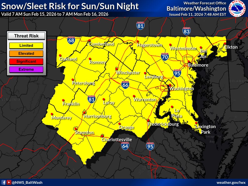
The National Weather Service currently has the entire area in a limited risk category for Sunday. In its early morning forecast discussion, forecasters said confidence is decreasing.
Model guidance has trended weaker overall, and ensemble probabilities for meaningful snow have dropped across the region. While a few individual model members still show larger totals, the overall likelihood is “dropping rapidly.”
The main reason is a southward trend in the storm track. If that continues, much of the region may see little precipitation at all. Timing has become a bit more consistent, focusing on Sunday into Sunday night, which could leave Saturday relatively mild with above average temperatures.
That warmth creates another challenge. Even if snow falls, ground and air temperatures may struggle to support accumulation without a significant change in the pattern.
Forecasters emphasized the threat is not zero, especially west of the Blue Ridge, but the trend is away from a widespread high impact event for areas near and east of DC. As Kammerer noted, this setup will likely continue to seesaw before a clearer solution emerges.
