The National Weather Service has increased projected snowfall totals across the region, but forecasters stress that the range of possible outcomes remains extremely wide, reinforcing a classic boom-or-bust setup ahead of Sunday into Monday.
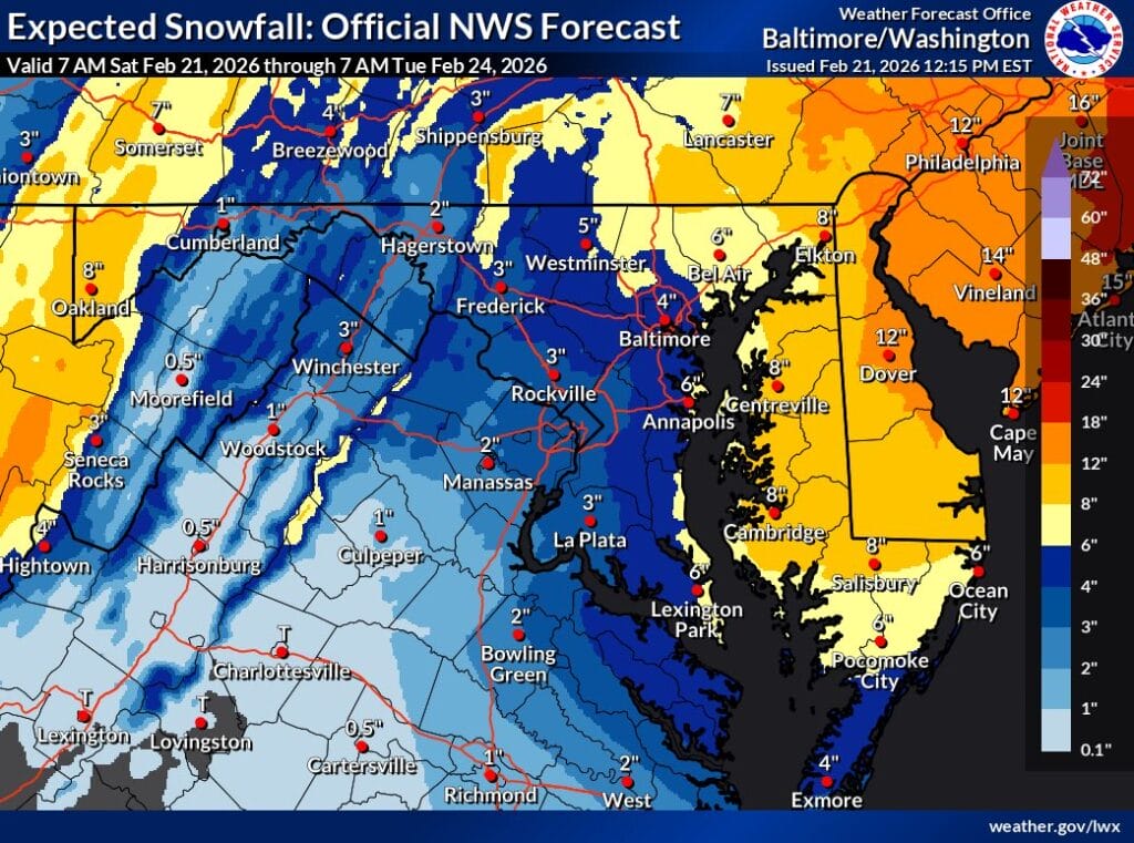
The latest official NWS snowfall forecast shows several inches possible across much of the DC area, with higher amounts north and east (about 3-5 inches across most of the area). However, the accompanying probability maps highlight just how uncertain this storm remains. For the immediate DC metro area, the chance of seeing six inches or more is still relatively modest, while significantly higher totals remain a lower-probability outcome.
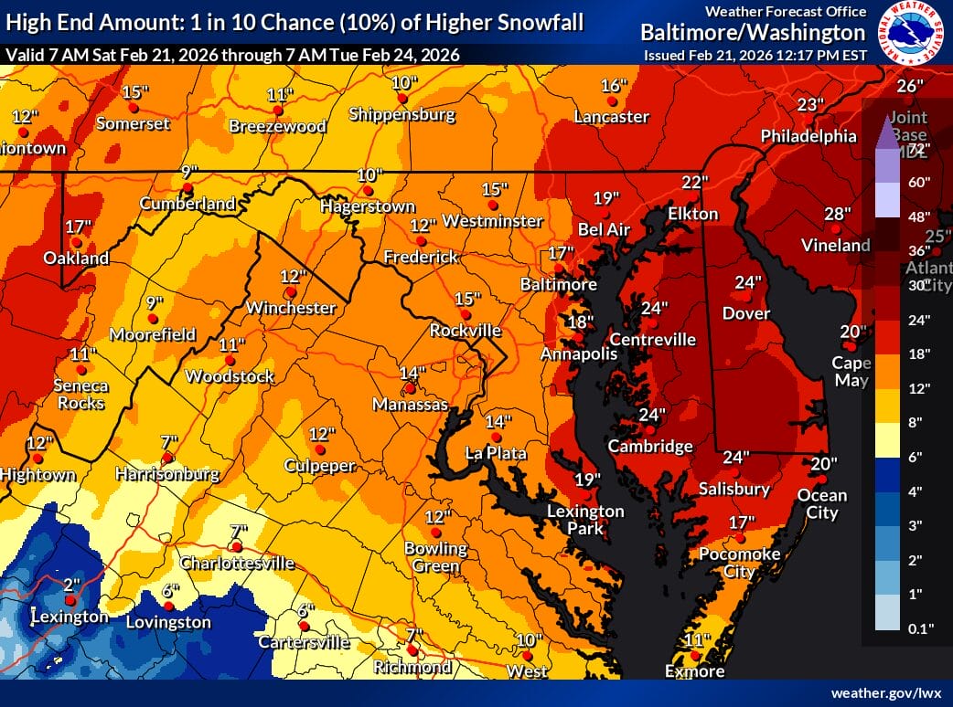
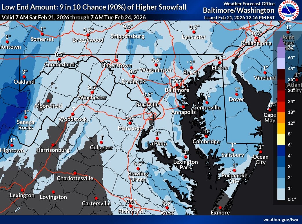
One NWS map illustrates the high end scenario, representing a 10% chance of heavier snowfall (15 inches in Rockville). In that outcome, parts of Maryland and the broader Mid-Atlantic could see totals well into the double digits, especially north and east of DC. Another map shows the low-end scenario, which reflects a much more common outcome and keeps totals considerably lower, in some cases closer to half of an inch.
Despite the uncertainty, the National Weather Service has issued a Winter Storm Watch for much of the region, signaling the potential for impactful conditions. The watch is in effect from Sunday afternoon through Monday morning for the District of Columbia, portions of central and southern Maryland, and central and northern Virginia.
According to the NWS, heavy snow is possible, with total accumulations of five inches or more within the watch area. Forecasters also note that winds could gust as high as 35 mph, which may lead to reduced visibility and difficult travel conditions.
The timing of the storm could be especially problematic, as hazardous road conditions may impact the Monday morning commute. Officials are urging residents to monitor forecast updates closely and begin planning now for the possibility of slippery roads and disrupted travel.
While snowfall totals remain far from locked in, the expanding range of outcomes underscores why confidence is still low just hours before the event. Whether the region ends up on the low end or closer to the higher-impact scenario will depend on subtle shifts in storm track, temperatures, and precipitation type that will continue to be refined over the next day.