A light wintry mix could lead to slippery travel across parts of the region late Monday night into Tuesday morning, according to the National Weather Service (NWS).
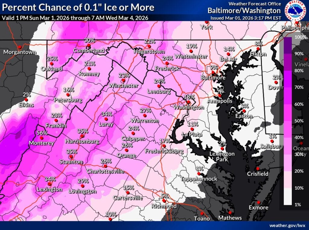


A light wintry mix could lead to slippery travel across parts of the region late Monday night into Tuesday morning, according to the National Weather Service (NWS).

An Extreme Cold Alert has been issued for Montgomery County from 9pm Sunday, March 1 through 3pm Monday, March 2 as wind chill values are expected to fall below 32 degrees. Officials are urging residents to dress in layers, limit time outdoors when possible, and take precautions if they must spend extended periods outside. (more…)
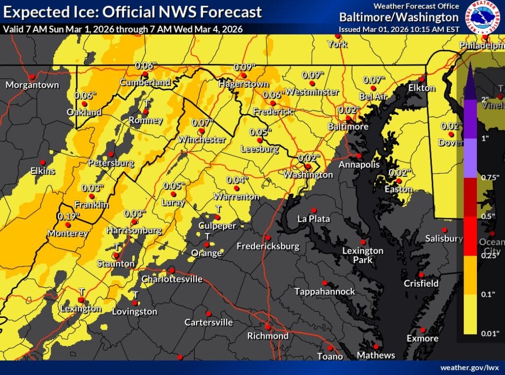
A period of freezing rain is increasingly likely across parts of the region late Monday night into Tuesday morning, with the National Weather Service (NWS) flagging ice as the primary concern rather than snow.
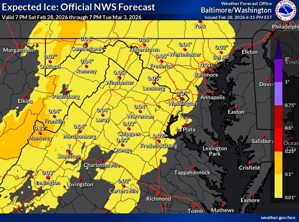
While the snow threat for Monday has largely dried up, National Weather Service (NWS) forecasters are still tracking a period of wintry mix Monday night into Tuesday morning across much of the region.
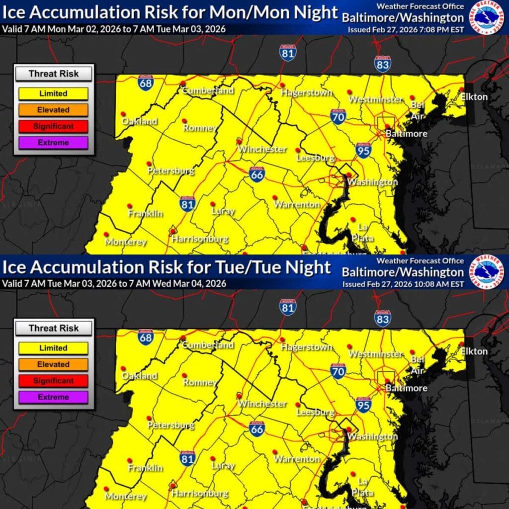
After some back-and-forth in the forecast, the latest outlook suggests the more significant impacts from a potential early-week winter system may largely miss the region.
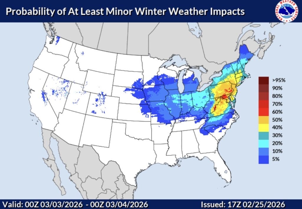
The National Weather Service has released a new map (featured photo) showing the “probability of at least minor winter weather impacts” for Monday, March 2, with most of Maryland now falling in the 50 to 70 percent range.
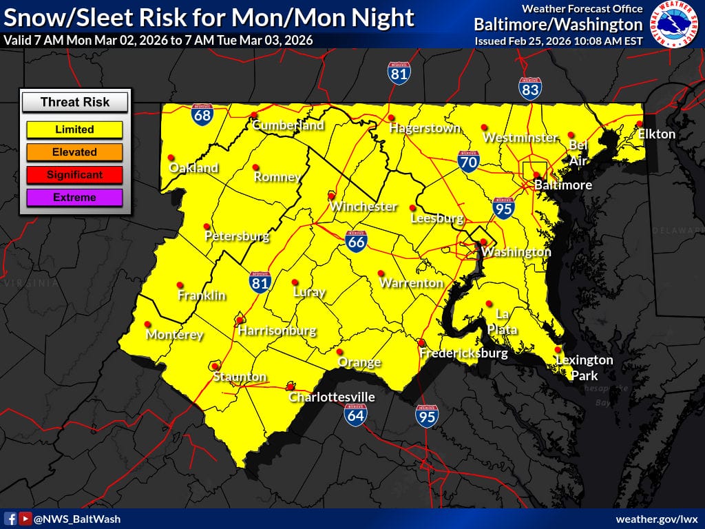
The National Weather Service has placed most of Maryland and Northern Virginia in a “limited threat risk” category for potential winter weather on Monday.
An Extreme Cold Alert has been issued for Montgomery County, Maryland until Wednesday, February 25 at 9am due to wind chill values expected to fall below 32 degrees Fahrenheit. Officials are urging residents to wear layers, limit time outdoors when possible, and take extra precautions if spending extended time outside. (more…)
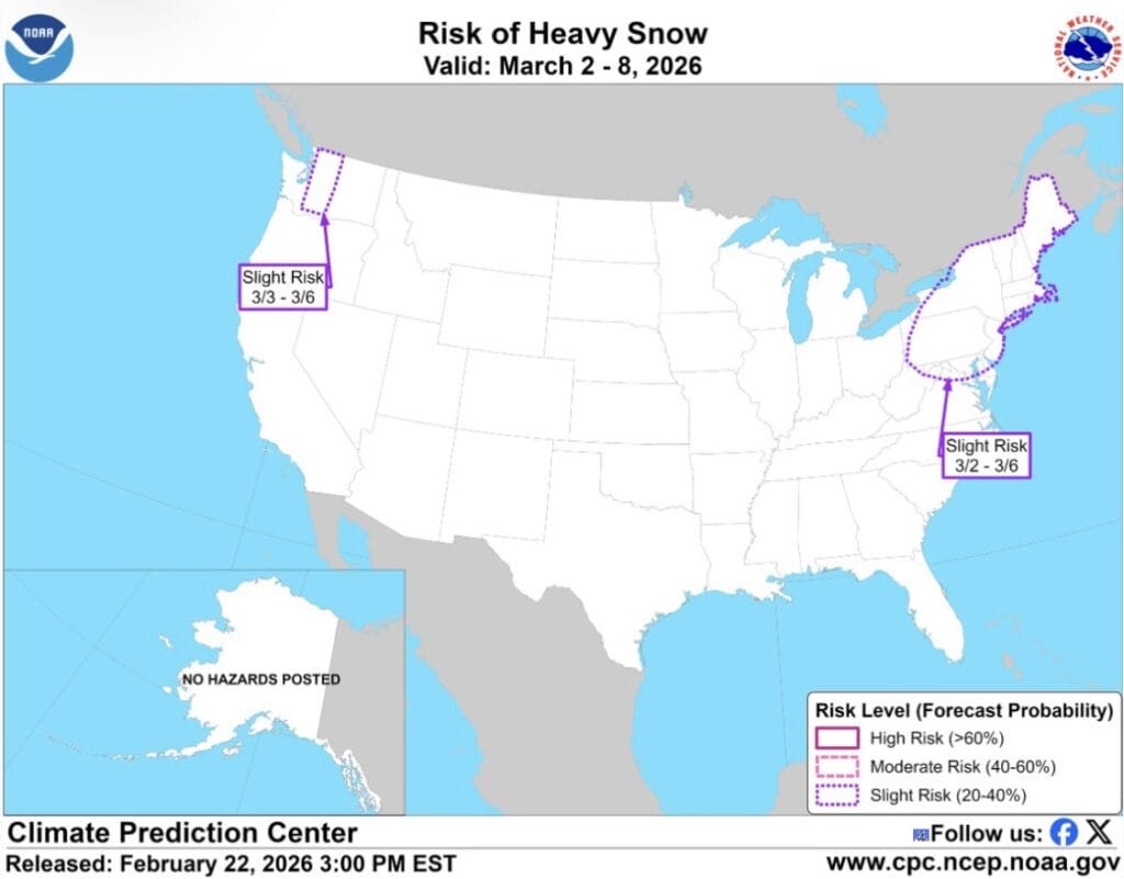
The National Weather Service’s Climate Prediction Center has included most of Maryland in a “Slight Risk of Heavy Snow” zone for the period of March 2nd through March 8th, putting early March on the radar for potential winter weather.That outlook, however, is being met with some skepticism locally.
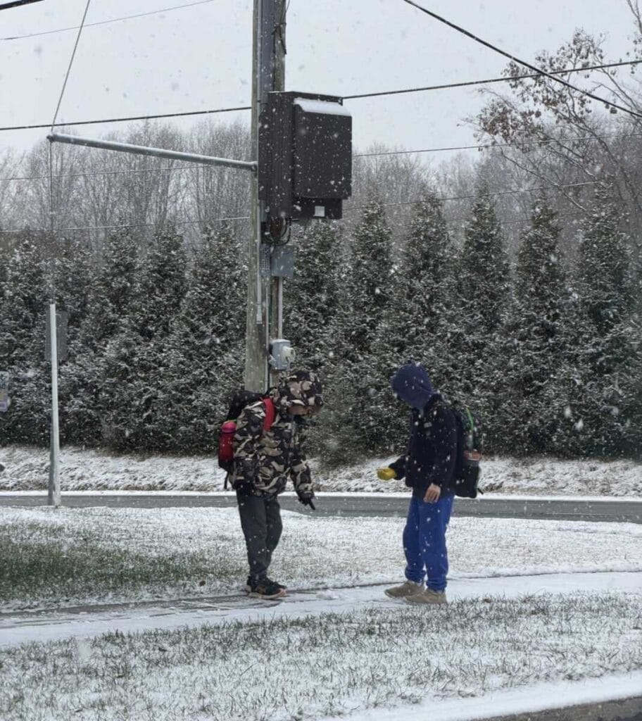
Montgomery County Public Schools’ request for a waiver from the Maryland State Department of Education following weather-related closures from the previous storm was denied. Since then, an additional day has been added to extend the school year for students to Friday, June 26th.
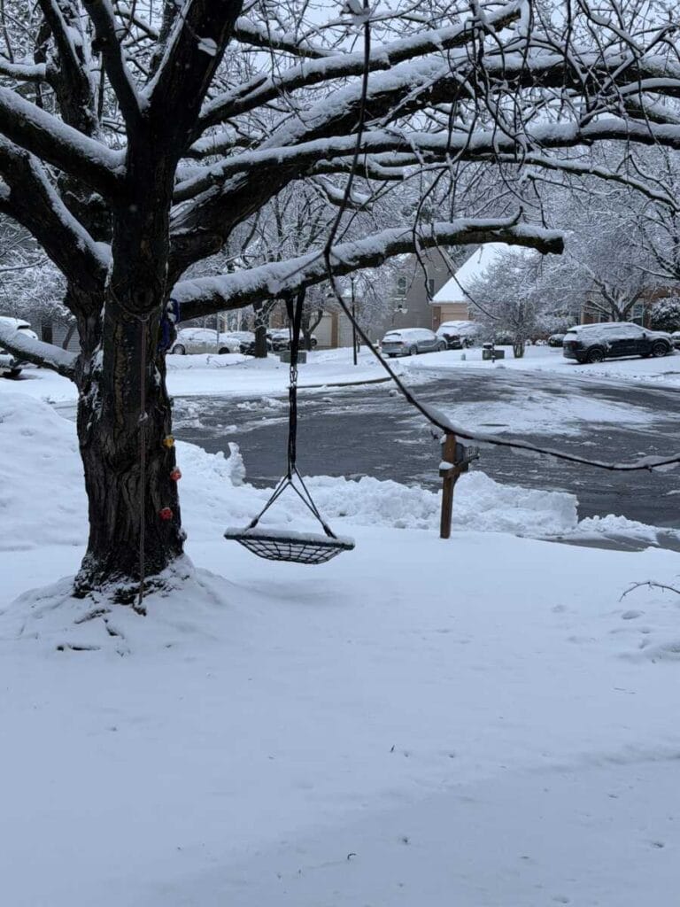
The National Weather Service has released some snow totals from trained spotters across the DMV at various times Sunday night and Monday morning. Not every community has an available measurement, and the timing of each report can lead to differences in what you’re seeing at home. Your backyard may look a bit different from the official totals, depending on when and where the snow was measured.