The National Weather Service Weather Prediction Center has expanded its “Heavy Snow Threat” area to include most of Maryland, signaling growing concern about the potential for impactful winter weather late this weekend into early next week.

The National Weather Service Weather Prediction Center has expanded its “Heavy Snow Threat” area to include most of Maryland, signaling growing concern about the potential for impactful winter weather late this weekend into early next week.
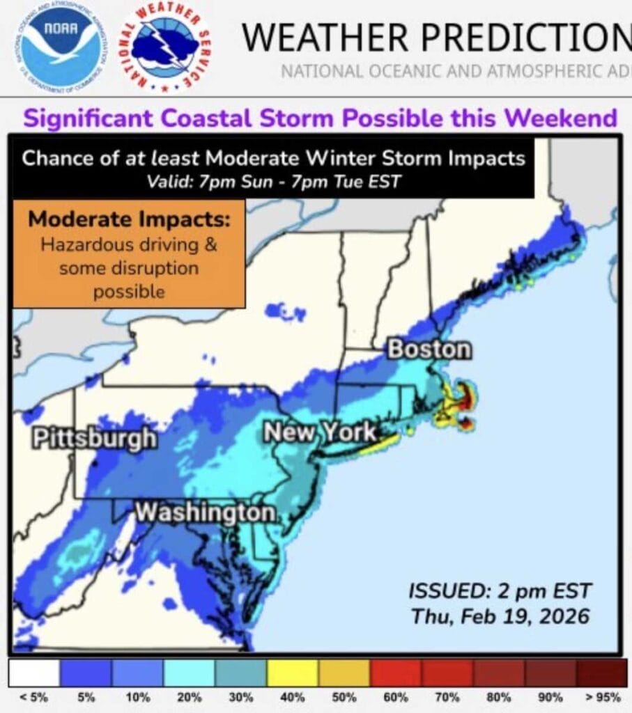
Forecast uncertainty remains high as the National Weather Service Weather Prediction Center highlights the potential for a coastal storm to develop near the East Coast late this weekend, with confidence in storm formation higher than confidence in specific local impacts. Officials caution that small shifts in the storm’s track could mean anything from minimal impacts to accumulating snow and strong winds.

NBC4 meteorologist Doug Kammerer says confidence remains low as weather models continue to show vastly different outcomes for a potential winter storm expected Sunday. In a Wednesday night social media post, Kammerer highlighted the sharp contrast between the GFS and European models, which are painting very different snowfall scenarios for Maryland.
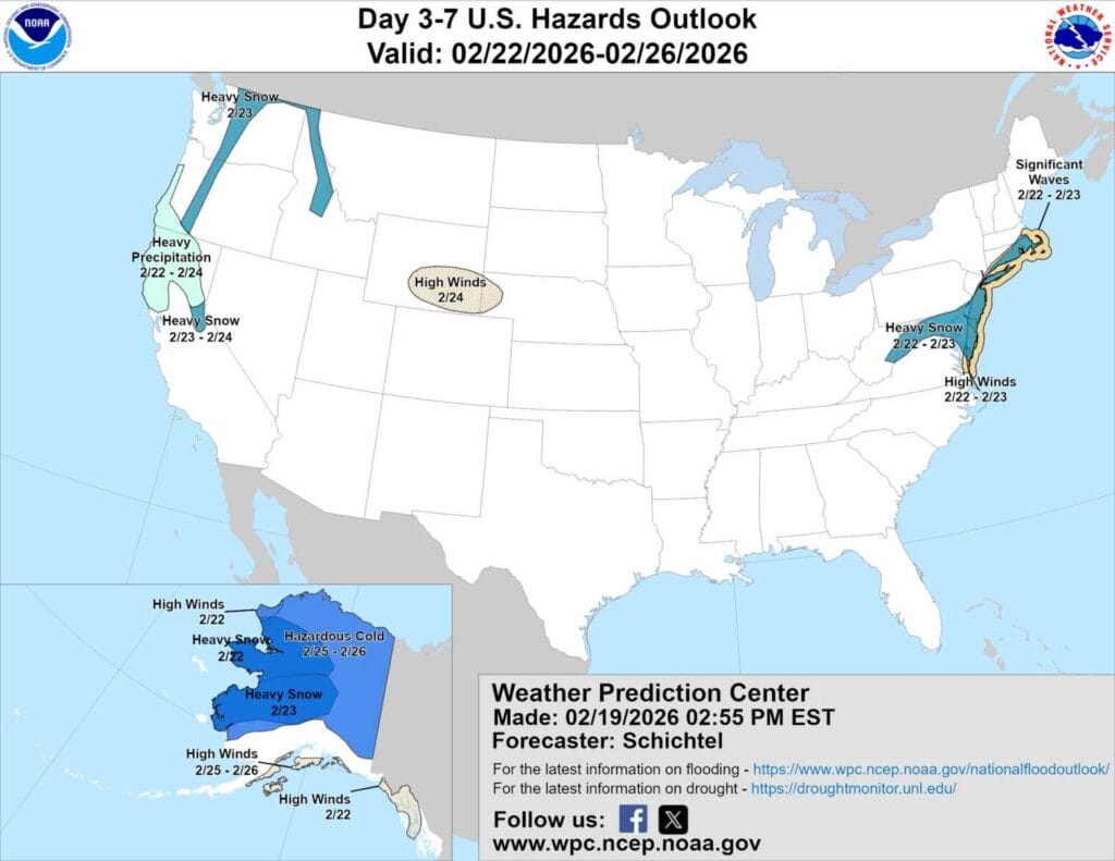
The National Weather Service Weather Prediction Center (WPC) released an updated hazards outlook placing parts of Maryland just east of our immediate area within a “Heavy Snow” risk zone as forecasters continue to monitor a potential winter storm for Sunday into Monday.
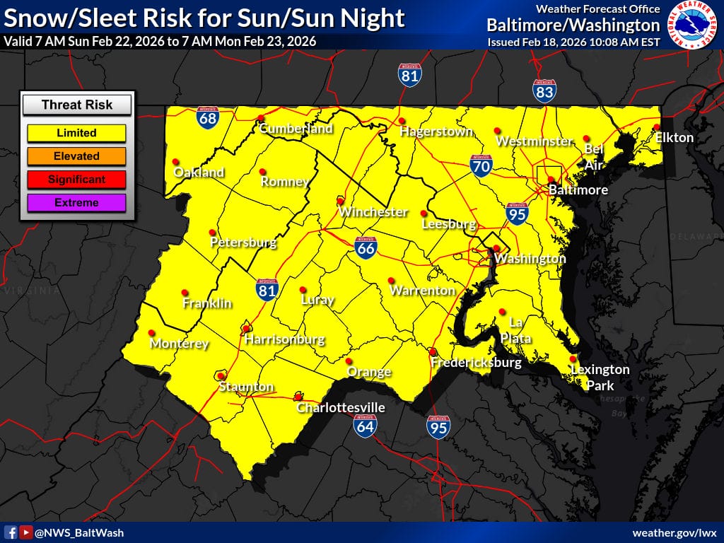
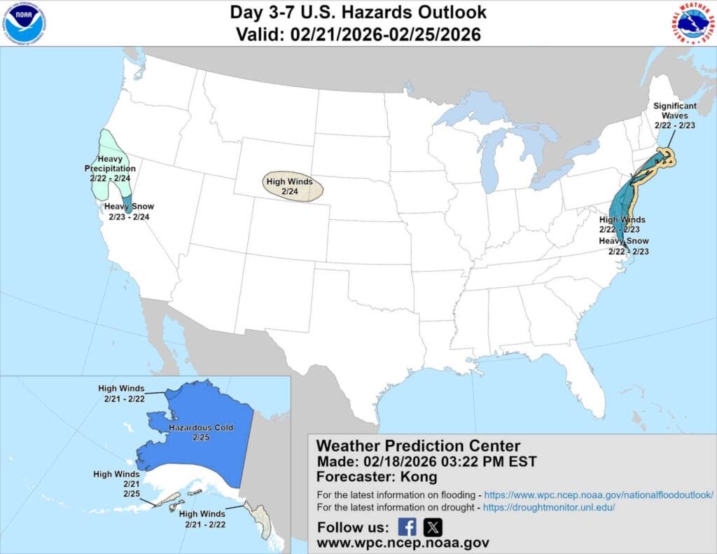
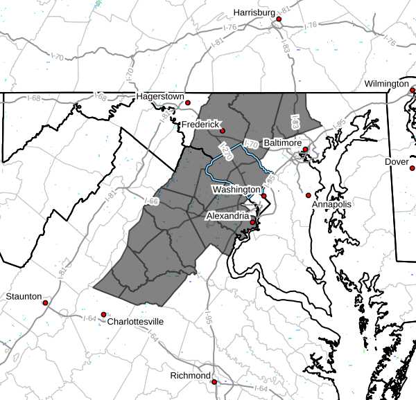
Maryland and Northern Virginia are currently in the National Weather Service’s (NWS)“limited threat risk” zone for a potential winter storm this weekend, with forecast confidence still low.
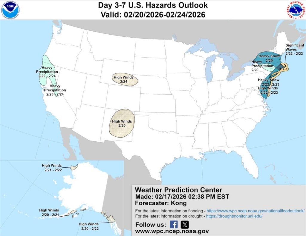
Parts of Maryland just east of Montgomery County were included in the National Weather Service Prediction Center’s “heavy snow” hazard outlook for February 22 and 23, Sunday into Monday. Overnight forecast models have since trended weaker, pushing the potential storm farther out to sea, but forecasters say it remains something to watch.

NBC4 meteorologist Doug Kammerer says another potential snow event is on the table for this weekend (likely Sunday), with the Euro AI ensemble mean showing 5 to 7 inches of snow across much of Maryland and Northern Virginia.
A dense fog advisory is in effect across parts of central and northern Maryland, including Montgomery County, as well as portions of northern Virginia, according to the National Weather Service. (more…)

FOX5 meteorologist Mike Thomas says the DC Metro area is in for a warmer stretch this week, but winter may not be finished just yet.
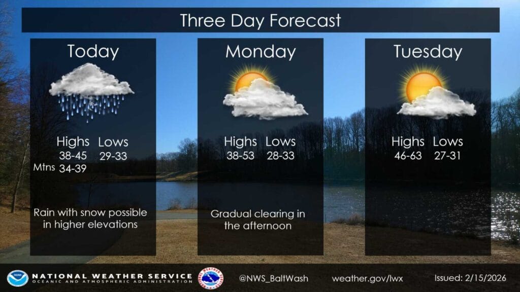
A chilly, soaking rain is expected to move through Montgomery County and much of the surrounding region today and tonight, according to the National Weather Service, with no meaningful snow expected locally.

An Extreme Cold Alert has been issued for Montgomery County, Maryland from Friday, 2/13 at 9pm until Saturday, 2/14 at 9am, due to wind chill values expected to fall below 32 degrees Fahrenheit. Officials are urging residents to wear layers, limit time outdoors when possible, and take extra precautions if spending extended time outside. (more…)