The National Weather Service has increased projected snowfall totals across the region, but forecasters stress that the range of possible outcomes remains extremely wide, reinforcing a classic boom-or-bust setup ahead of Sunday into Monday.
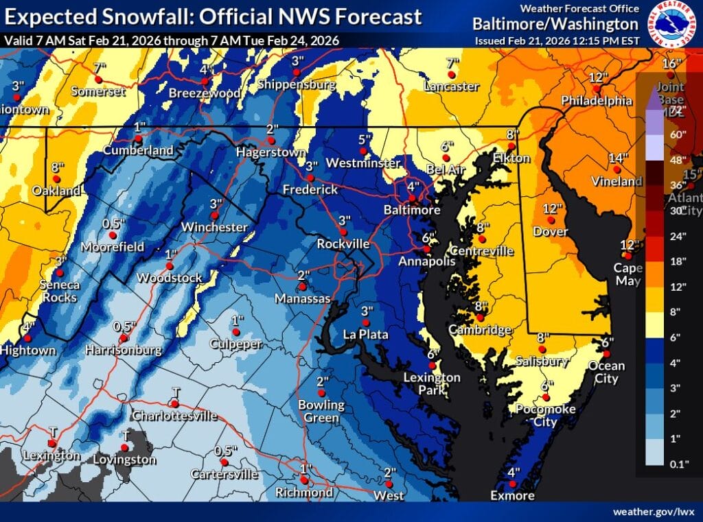


The National Weather Service has increased projected snowfall totals across the region, but forecasters stress that the range of possible outcomes remains extremely wide, reinforcing a classic boom-or-bust setup ahead of Sunday into Monday.
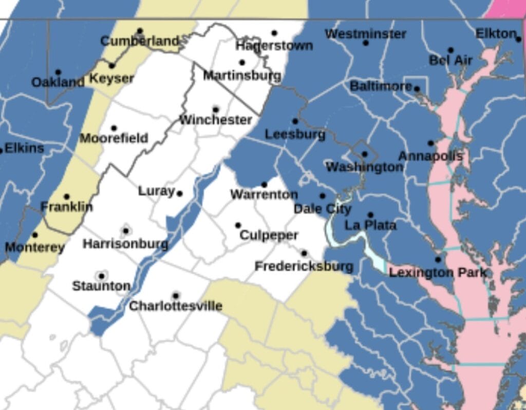
The Winter Storm Watch has expanded to include more of Maryland (now including anll of Montgomery County), DC, and Northern Virginia, as confidence grows in a potentially impactful storm late Sunday into Monday.
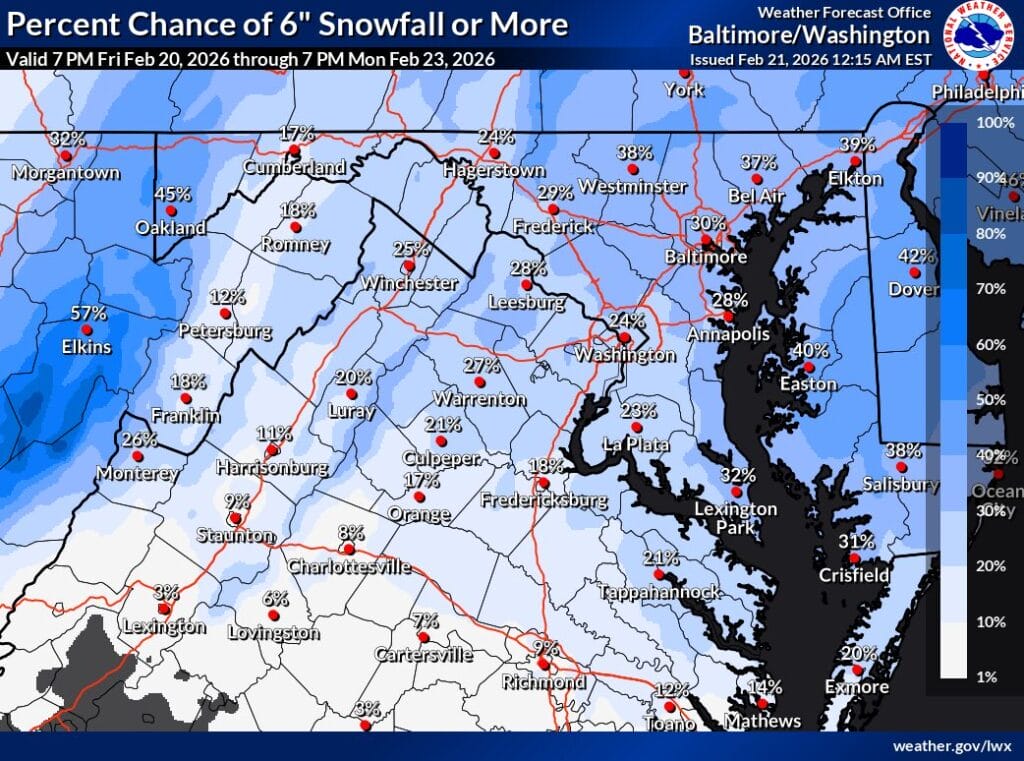
A Winter Storm Watch is in effect from Sunday afternoon through Monday morning as NBC4 meteorologist Doug Kammerer says forecast confidence remains unusually low just 36 hours out from the next potential storm.
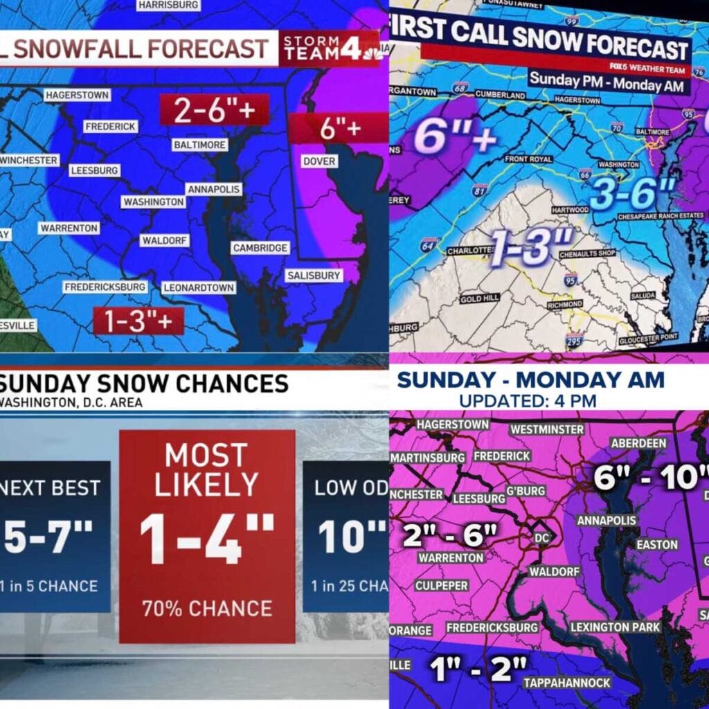
A Winter Storm Watch is now in effect from Sunday afternoon through Monday morning for a large portion of Maryland and Northern Virginia, and the region’s four major TV weather teams have released their first call snowfall maps. While details are still being refined, all indications point to a potentially impactful event, especially late Sunday into early Monday.
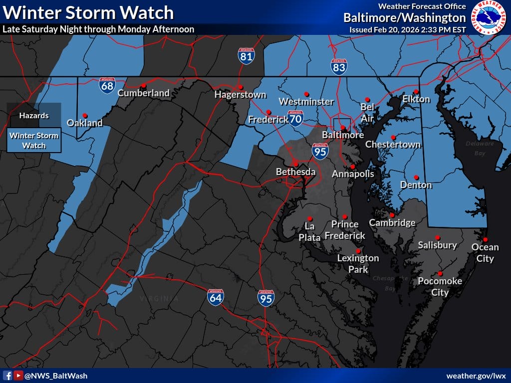
A Winter Storm Watch has been issued for portions of Maryland (including NW Montgomery County) and Northern Virginia from Sunday afternoon through Monday morning, with the potential for significant snowfall across the region.
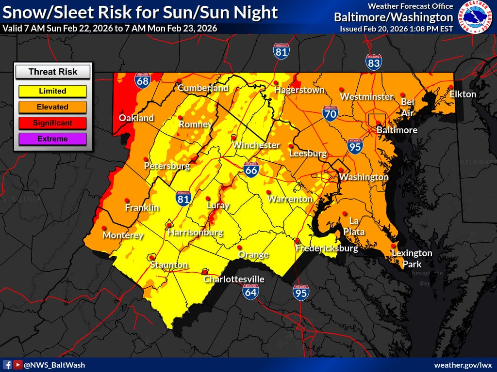
NBC 4 meteorologist Doug Kammerer is flagging growing confidence in a significant winter storm for Sunday into Monday, even as major forecast models remain far apart on snowfall totals.
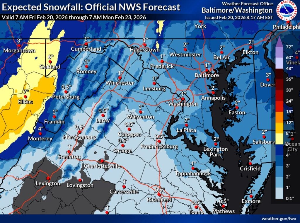
Forecast models continue to show a wide range of outcomes for a potential winter storm late Sunday into Monday, which is why official snowfall projections remain conservative for now. While some guidance suggests the possibility of heavier snow, confidence remains low, especially east of the mountains and below 1500 feet.
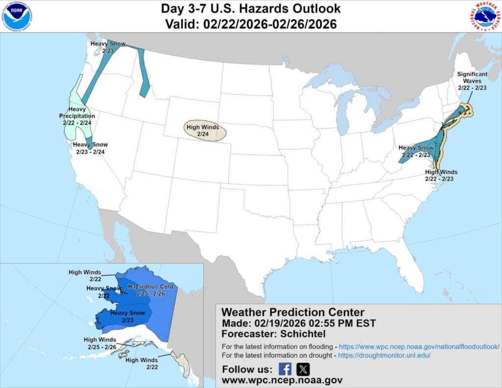
The National Weather Service Weather Prediction Center has expanded its “Heavy Snow Threat” area to include most of Maryland, signaling growing concern about the potential for impactful winter weather late this weekend into early next week.
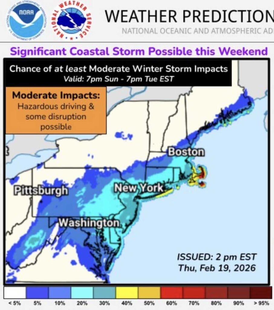
Forecast uncertainty remains high as the National Weather Service Weather Prediction Center highlights the potential for a coastal storm to develop near the East Coast late this weekend, with confidence in storm formation higher than confidence in specific local impacts. Officials caution that small shifts in the storm’s track could mean anything from minimal impacts to accumulating snow and strong winds.
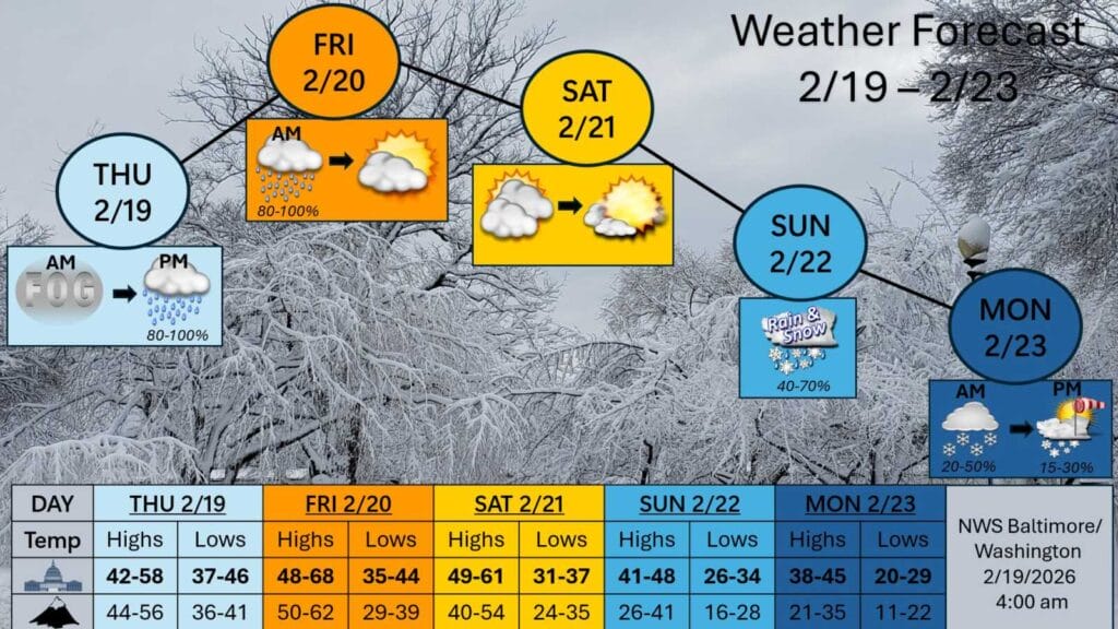
NBC4 meteorologist Doug Kammerer says confidence remains low as weather models continue to show vastly different outcomes for a potential winter storm expected Sunday. In a Wednesday night social media post, Kammerer highlighted the sharp contrast between the GFS and European models, which are painting very different snowfall scenarios for Maryland.
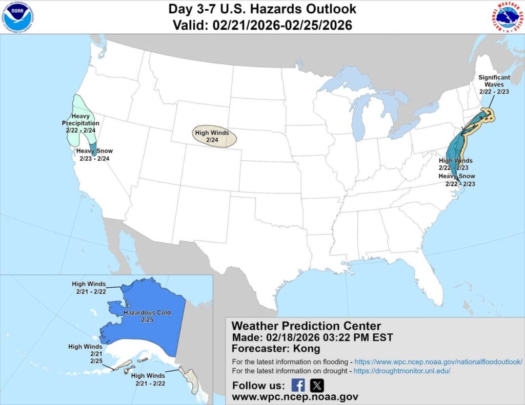
The National Weather Service Weather Prediction Center (WPC) released an updated hazards outlook placing parts of Maryland just east of our immediate area within a “Heavy Snow” risk zone as forecasters continue to monitor a potential winter storm for Sunday into Monday.