Markoff’s Haunted Forest, located at 19120 Martinsburg Rd in Dickerson, is one of Maryland’s greatest Halloween events. This past October, Markoff’s celebrated its 30th anniversary. The spooky attraction has closed for the season, but recently shared that it has officially “terrorized” over 1 million people.
This year was the culmination of MHF’s 30 years in the business, which started on September 30th: “2022 is going to be epic. Heart-pounding scares; Terrifying , twists & turns; Eerie glades & creepy trail ghouls; and Fright-full scenes for you to tremble your way through like Mummy’s little kitten.” And epic it was, reaching a milestone that makes MoCo proud.
https://www.instagram.com/p/Ckro6pxjeCM/?igshid=YmMyMTA2M2Y=
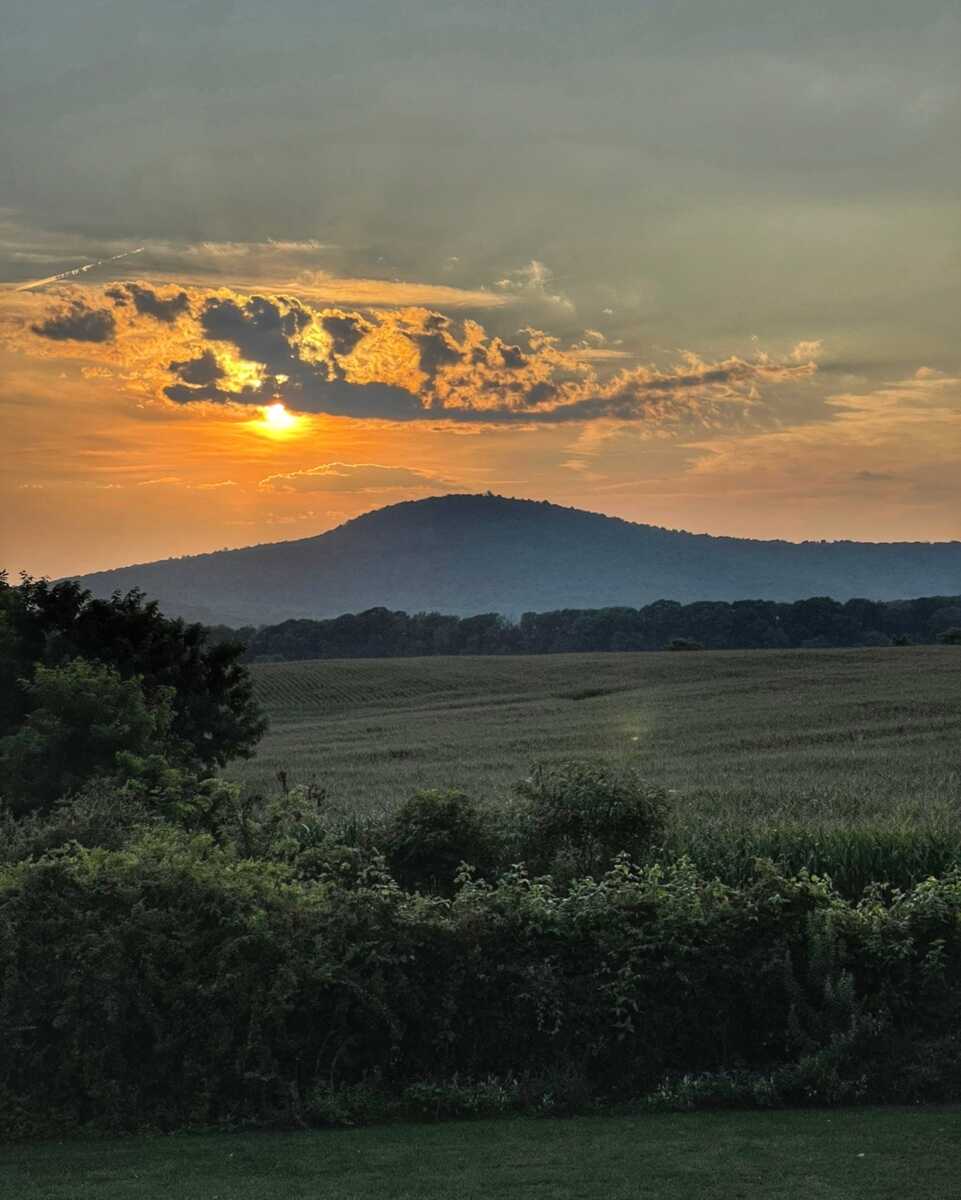
The Frederick County Council voted for the approval of the Sugarloaf Treasured Landscape Management Plan on Tuesday, passing the plan to preserve Sugarloaf Mountain and surrounding land, but pushed back a decision on development restrictions in the area to the council that will take office in December, following the November elections (according to a report by Jack Hogan of the Frederick News Post).
The Washington Post reports that the Frederick County Council rejected a last minute compromise, 4-3, that could lead to further conflict between county officials and the property owner. Frederick County Executive Jan Gardner expressed disapproval of the compromise at the meeting, while County Councilmember Kai Hagan, who proposed the compromis, referred to it as “an effort to advance the strongest plan we can get”.
For now, Sugarloaf Mountain Remains open to the public.
Because the overlay was not a part of the plan when the council voted on it, there is no reason to close the mountain, John Webster, president of the Stronghold Board of Trustees, said in a phone interview with the News-Post.

The Frederick County Council unanimously voted to postpone its decision on a plan to preserve Sugarloaf Mountain and its surrounding area during its meeting on Tuesday, October 18th. The vote on the Sugarloaf Treasured Landscape Management Plan will now take place on October 25th.
Original report: Stronghold, a non-profit corporation organized in 1946 by the late Gordon Strong, owns and operates the Sugarloaf mountain property “for the public’s enjoyment and education in an appreciation of natural beauty.” The Frederick County Council is scheduled to vote in today’s meeting (October 18th) on whether to approve the Sugarloaf Treasured Landscape Management Plan that includes standards for development in the plan area and prohibits certain uses, including carnivals, shooting ranges and landfills, per the Frederick News Post.
At last week’s Frederick County Council meeting, attorney Noel Manalo, representing Stronghold, said, “If the Sugarloaf plan as presented for public hearing on Oct. 11 passes, Stronghold will cease allowing general public access to Sugarloaf Mountain, a privately owned property, to allow Stronghold to evaluate the effects of the plan on its operations, but if modifications are made to the plan prior to final passage, Stronghold will reevaluate its decision.”
According to the Frederick News Post article, Frederick County Councilman Phil Dacey, R, proposed that the council exempt Stronghold’s 3,400 acres from the overlay, which covers the entire 20,000-acre plan area. County Councilman Steve McKay, R, introduced an amendment to strike 45 acres of Stronghold’s land from the overlay district. The council voted 6-1 against Dacey’s amendment and 4-3 against McKay’s. The full plan can be seen here and the Frederick County Council is scheduled to vote on it in today’s meeting.
With Halloween just two weeks away, there’s still time to check out some of the spookiest haunted forests and attractions in and around Montgomery County.
1. Field of Screams – 4501 Olney Laytonsville Rd, Olney
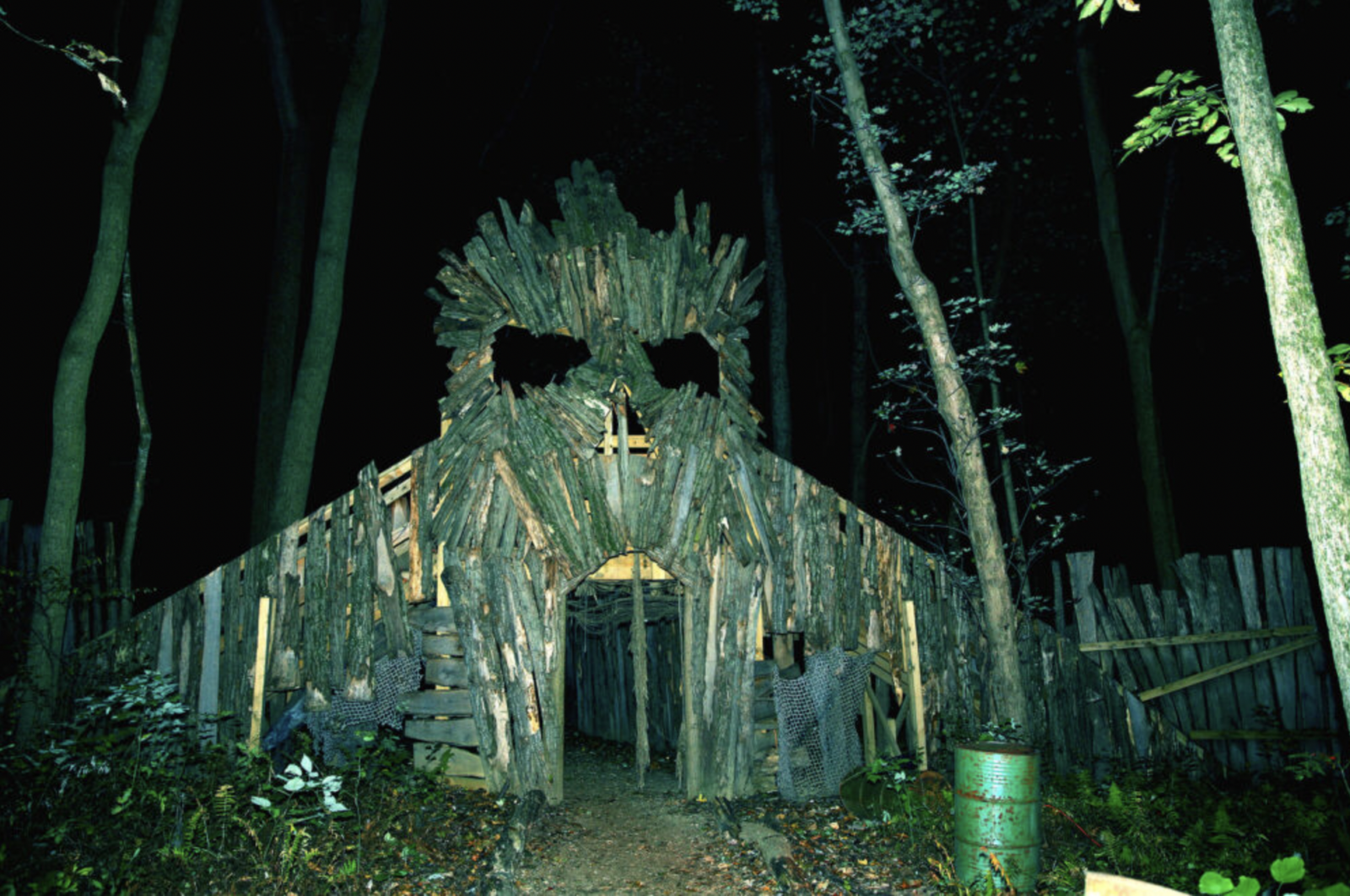
Field of Screams, now in its 22nd year in business, was recently voted as the #1 spot in USA Today’s 10 Best Haunted Attractions in the country. Located in Olney, this Hollywood-level production includes well-trained actors and an intense fright experience with decor and props not seen outside the movie industry.
“Enter a horrifically terrifying world beyond imagination at the Fields of Screams in Olney, Maryland. A good walk through the woods on The Haunted Trail and Trail of Terror leaves visitors scurrying away. Along their journey, guests are welcomed into thirteen haunted houses, where they might find anything from dead bodies to hillbillies and butchers. Enjoy Body Bean Bag Pumpkin Toss, Zombie Brain Smash, and other Carnival Town Games for a thrilling, competitive experience.”
General admission tickets start at $44 and include the Slaughter Factory which is a high-end haunted house experience where every detail has been attended to; a one-hour trail of 27 stations; and a compound with over 20 bonfires, tasty concessions, and scares and fun for all (recommended for ages 12 and over). The 2022 Field of Screams Maryland is truly an immersive Halloween attraction. All tickets must be purchased in advance at www.screams.org. Field of Screams Maryland is located at 4501 Olney Laytonsville Rd., Olney, MD just 30 minutes from Washington DC, downtown Baltimore and Northern Virginia. Open every Friday and Saturday in October and most Thursdays and Sundays. Follow Field of Screams Maryland on Facebook and Instagram (@fieldofscreamsmaryland).
2. Markoff’s Haunted Forest – 19120 Martinsburg Rd, Dickerson
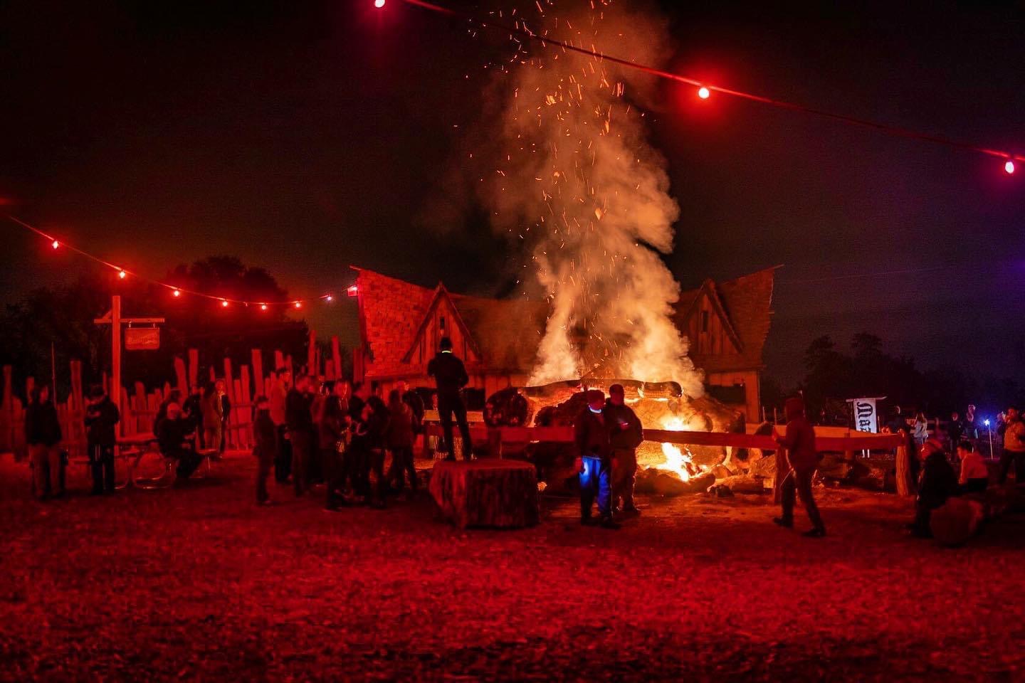
This year, Markoff’s Haunted Forest in Dickerson is celebrating its 30th anniversary. According to their website, “2022 is going to be epic. Heart-pounding scares; Terrifying , twists & turns; Eerie glades & creepy trail ghouls; and Fright-full scenes for you to tremble your way through like Mummy’s little kitten.”
Per Markoff’s Haunted Forest: MHF tickets should be purchased in advance online. Trail tickets are time stamped, and patrons will be admitted to the Trail according to the time stamp on their per-purchased ticket. Town tickets are sold based on full night capacity, and you should allow about an hour for this attraction. Please plan THE TOWN experience to fit with your TRAIL TIME. The last wagon to Onslaught Mills departs at 10:30pm. Admission to the CURSED VILLAGE is free and open ended. You can hang out here all night. Food, drinks, MHF swag & activities are all available for purchase with credit card. You may arrive to the MHF Village at any time, but you will not be admitted to the Trail until your ticket time. The parking lot entrance opens at 7pm and closes at 10pm. Everyone who is in BEFORE 10pm can stay until the last group completes their Trail experience.
“Since 1992, when the Markoff brothers started with a Haunted School Bus driven to events and festivals around DC, our haunt has provided fright fest lovers with a creative, dramatic, and – YES — terrifying haunt experience. Our creative team combines music, lights, scents, actors, make-up & prosthetics, and artistic brilliance in a series of high-tech, detailed scenes that consistently place MHF among the top haunts in the country.”
3. Leech Woods – 11201 Bethesda Church Rd, Damascus

Leech Woods is brand new in 2022 and is described as “a thirty minute immersive haunted trail experience of dark terror” that promises a night of chain saws, clowns and dark corners. Leech Woods also offers food and drink, four bonfires, axe throwing, a DJ booth, fortune telling, and other forms of entertainment each night.
Per Leech Woods: According to Montgomery County historical land records, the present site of Leech Woods was originally settled by Warwick and Jeanne Leech and their six children sometime in early 1790. Having immigrated from Hungary, the family chose Damascus, Maryland based on its temperate climate and heavily wooded region which reminded them of their homeland. The Leech family store thrived as the leading local merchant of hides, furs and hunting supplies. During the disastrous Winter of 1804, the Leech family store was robbed and vandalized by unknown attackers and the body of John Leech, the youngest son, was found nailed to the back wall of the store. The remaining bodies of the family members were later found bludgeoned and bound inside of the root cellar of their homestead. No further information about the attackers or motives for the killings are known.
4. Kindred Hills – 8421 Ball Road Frederick

Just outside of Montgomery County, Kindred Hills is a fun and scary Halloween event located in Frederick, MD off of Rt. 355, between Frederick and Urbana. In addition to the haunted trail and hayride, Kindred Hill also offers axe throwing and private fire pits. Tickets available here.
Do you dare to enter the domain of the hills? The madness starts with a hayride into the darkness. A dimly lit trail through the woods will lead you past remnants of a previous time, then back to the safety of the modern day.

Markoff’s Haunted Forest, located at 19120 Martinsburg Rd in Dickerson, is one of Maryland’s greatest Halloween events. For its 30th anniversary, you’ll experience the culmination of MHF’s 30 years in the business starting September 30th: “2022 is going to be epic. Heart-pounding scares; Terrifying , twists & turns; Eerie glades & creepy trail ghouls; and Fright-full scenes for you to tremble your way through like Mummy’s little kitten.”
Per Markoff’s Haunted Forest: MHF tickets should be purchased in advance online. Trail tickets are time stamped, and patrons will be admitted to the Trail according to the time stamp on their per-purchased ticket. Town tickets are sold based on full night capacity, and you should allow about an hour for this attraction. Please plan THE TOWN experience to fit with your TRAIL TIME. The last wagon to Onslaught Mills departs at 10:30pm. Admission to the CURSED VILLAGE is free and open ended. You can hang out here all night. Food, drinks, MHF swag & activities are all available for purchase with credit card.
You may arrive to the MHF Village at any time, but you will not be admitted to the Trail until your ticket time. The parking lot entrance opens at 7pm and closes at 10pm. Everyone who is in BEFORE 10pm can stay until the last group completes their Trail experience.
“Since 1992, when the Markoff brothers started with a Haunted School Bus driven to events and festivals around DC, our haunt has provided fright fest lovers with a creative, dramatic, and – YES — terrifying haunt experience. Our creative team combines music, lights, scents, actors, make-up & prosthetics, and artistic brilliance in a series of high-tech, detailed scenes that consistently place MHF among the top haunts in the country.”
The Maryland Department of Natural Resources – Wildlife and Heritage Service plants sunflowers each spring on the McKee-Beshers Wildlife Management Area (WMA). The primary purpose for planting sunflowers on wildlife management areas is to provide a food source for mourning doves, as well as other wildlife species, after the plants mature and dry. Mourning doves are hunted at these fields during hunting seasons that traditionally begin on September 1 and continue through early January. In recent years, the sunflower fields have become a popular destination for planned and impromptu photo shoots. According to photos sent in to us from across the county, the sunflowers are currently looking great, but it may not last long (featured photo courtesy of JoMatt Mendoza.
From the Maryland Department of Natural Resources: A number of fields are planted each year, although two fields are designated as Dove Management Fields. The Dove Management Area fields have restricted times and days when hunting can occur during the month of September. In addition to mourning doves, sunflowers and sunflower seeds are a favorite food source for a host of other songbirds, mammals and pollinators. Sunflowers require pollination by insects, usually bees, to produce a seed crop. In turn, honey bees and many species of native bees, benefit from the abundant nectar and pollen that sunflowers produce.
The many benefits of sunflowers are lost when they are cut or trampled by people. These sunflowers are planted for the benefit of wildlife and regulations prohibit the cutting, destruction or removal of any plants from these areas. The public is welcome to visit, admire and photograph the sunflowers in bloom. However, visitors must be responsible and ensure that their actions don’t have negative consequences.
Wildlife Management Area Access:
McKee-Beshers WMA may be accessed any time of day with no overnight camping allowed. There is no fee or permit required to access the property. Those interested in supporting our Wildlife Management Areas please see next section about FUNDING.
Funding:
Dove Management Areas are funded with hunting license fees and Federal Aid in Wildlife Restoration Funds, commonly known as Pittman–Robertson funds. Pittman Robertson funds come from a federal excise tax on sporting arms, ammunition, archery equipment and handguns. These funds are collected from the manufacturers and are distributed each year to the states and territorial areas by the Department of the Interior. Non-hunters interested in contributing financially to these sunflower fields may purchase a Maryland Migratory Game Bird Stamp. You do not need hunter education or a hunting license to purchase the stamp. The stamp is available online through COMPASS or at any location that sells hunting licenses. https://compass.dnr.maryland.gov/Security/Logon
How and when they are planted:
The techniques used to plant the sunflowers, and the sunflower variety planted, may change from year to year, as well as the number of acres planted and their locations. Sunflowers are planted in late April or early May. Weather, seed variety, weed competition, soil condition and herbivore damage will all impact the time that it takes for the plants to bloom. With favorable conditions, the sunflowers will bloom in mid-July.
After the sunflowers are done blooming and seeds are mature, in early to mid-August, strips are mowed through the sunflowers to scatter the seeds on the ground where they are more accessible to mourning doves and other wildlife.
Area Regulations:
- Destruction or removal of any plants (including sunflowers) is strictly prohibited.
- Parking is only allowed in designated parking areas.
- Do not block gates. Violators may be towed and ticketed.
- Driving is only allowed on main roads (River Road, Hunting Quarter Road, and Sycamore Landing Road). Only authorized or emergency vehicles allowed behind gates.
- Dogs are allowed, but must be leashed.
- Wildlife Management Areas are trash-free. No trash cans are provided. Please take all trash with you.
- Commercial activities are prohibited.
Directions:
From the Capital Beltway, take Exit 39 (River Road) west toward Potomac. Proceed for approximately 11 miles to the intersection of River Road and MD 112, Seneca Road. Turn left and continue on River Road for about 2 1/2 miles. McKee-Beshers will be on your left as you head west on River Road.
 Click here for a map
GPS Coordinates of sunflower fields
- Field #1: 39.075299, -77.421354
- Field #2: 39.084206, -77.413748
- Field #3: 39.075688, -77.402296
- Field #4: 39.079480, -77.389323
- Field #5: 39.080102, -77.375020
Tips for a successful visit:
- McKee-Beshers WMA has no bathroom facilities, no benches and no picnic tables. Please plan accordingly.
- McKee-Beshers WMA is home to ticks, mosquitoes and poison ivy. Long pants, bug spray and close-toed shoes are recommended.
- Please note that trails are unmanicured dirt or gravel that can be rough or muddy and may be unsuitable for strollers.
Courtesy of Montgomery Planning: Montgomery County is home to a surprising number of rural areas. The forward-thinking 1964 General Plan focused growth in defined corridors emanating from the population centers in and around the Capital Beltway. Between those corridors, the General Plan called for wedges of low-density residential uses, open space and protected farmland. The rural areas encompass the 93,000 acre Agricultural Reserve along with the larger rural communities of Damascus and Poolesville; small crossroad communities such as Beallsville, Sunshine and Dickerson; and areas with mixed open land and housing. Aerial video available below:
@themocoshow Aerial view of Montgomery County’s Agricultural Reserve. One-third of Montgomery County, or 93,000 acres, is designated as the Agricultural Reserve. #AgReserve #MoCo #AgriculturalReserve ♬ Way down We Go – KALEO
The Agricultural Reserve
In 1980, the Montgomery County Council made one of the most significant land-use decisions in county history by creating what we call the Agricultural Reserve. Heralded as one of the best examples of land conservation policies in the country, the Agricultural Reserve encompasses 93,000 acres – almost a third of the county’s land resources – along the county’s northern, western, and eastern borders.
The Agricultural Reserve and its accompanying Master Plan and zoning elements were designed to protect farmland and agriculture. Along with a sustained commitment to agriculture through the county’s Office of Agriculture, the combination of tools helps retain more than 500 farms that contribute millions of dollars to Montgomery County’s annual economy. This is a notable achievement in an area so close to the nation’s capital, where development pressure remains perpetual and intense.
Building Lot Termination (BLT) Program
Established by law in 2008, the Building Lot Termination Program (BLT) is a farmland preservation tool. A BLT easement restricts residential, commercial, industrial and other non-agricultural uses on a given property. The primary purpose of a BLT easement is to preserve agricultural land by reducing the fragmentation of farmland resulting from residential development.
Creating a BLT easement can provide additional compensation to a landowner who can demonstrate that his or her land is capable of residential development and agrees to forgo that development and terminate the approved waste disposal system associated with the lot.
Learn more about the Building Lot Termination Program.
How Can Residents Enjoy the Agricultural Reserve?
Although primarily a working agricultural landscape, the Agricultural Reserve offers county residents a plethora of activities. Check out the Reserve’s many opportunities — pick-your-own fruit farms, a winery, bike routes and pastoral scenic vistas — in a resource guide and map(opens in a new tab), produced in collaboration with the Montgomery Countryside Alliance(opens in a new tab). Beyond that, the Reserve represents a historic landscape as well as a resource that protects our public water supply and provides access to green open spaces.
For more information on agricultural preservation programs, farmers markets, and the Cooperative Extension Service, visit Montgomery County’s Office of Agriculture(opens in a new tab).
How does the Agricultural Reserve protect farmland?
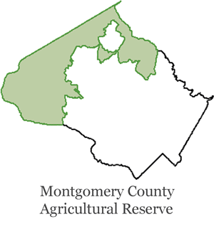 In 1980, after determining that there was a critical need to protect productive farmland in Montgomery County, the County Council and Planning Board adopted a Master Planaccompanied by a series of land use regulations and incentives designed to minimize inappropriate development, avoid the fragmentation of farmland by subdivision, strengthen agriculture and channel growth to down- county growth areas through rezoning with a transfer of development rights program.
The Master Plan was one of the first comprehensive plans for preservation of agriculture and rural open space that was linked to an established countywide growth management program. Its primary tools include:
- Agricultural Reserve (AR)
A zoning district created for the primary agricultural preservation areas within the Agricultural Reserve, with agriculture and related activities as its preferred uses. Residential development is limited to no more than one dwelling unit per 25 acres, although individual lots can be as small as one acre. - Rural Zone and Rural Cluster Zone (R and RC)
The two other primary zoning districts within the Agricultural Reserve, the rural and rural cluster zones, are used in areas featuring a mix of farmland, open space and low-density housing. Residential development is limited to no more than one dwelling unit per 5 acres. In the rural cluster zone, individual lots can be as small as one acre. - Transfer of Development Rights (TDR)
This is the primary mechanism to provide equity compensation to landowners in the RDT zone. TDR transfers residential development potential from the farmland preservation areas of the Agricultural Reserve into areas designated as better suited for growth.
Also see the Preservation of Agriculture & Rural Open Space master plan.
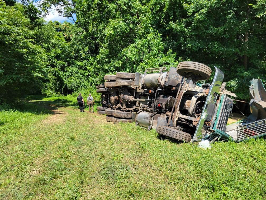
Montgomery County Fire and Rescue Services (MCFRS) we’re called to the scene of a collision that led to an overturned 18-wheeler that trapped the driver under the vehicle, and live power lines in the area of White Acres Farm on Darnestown Rd. near Dickerson Rd. (on the backside of Woodside Equestrian Center) in the Dickerson/Poolesville area at approximately 2:15pm on Wednesday Afternoon, according to MCFRS Chief Spokesperson Pete Piringer.
Upon arrival, MCFRS crews found the overturned grain hauler well off of the hard surface road with the driver requiring extrication. Utility terrain vehicles (UTVs) assisted in getting to the site of the overturned vehicle, and crews were able to remove the driver for evaluation. The driver was then transported to a local trauma center for Pri2 trauma (serious, but non-life-threatening injuries).
As of now, there is no word on how the crash occurred.
Update – IAO White Acres Farm, Darnestown Rd, Dickerson, (backside of Woodstock equestrian Center), 18-wheeler TT, grain-hauler, flipped over, @MCFRS_EMIHS transporting 1 adult Pri2 trauma, NLT https://t.co/rM9KIri4xt pic.twitter.com/gUDzUPxYt3
— Pete Piringer (@mcfrsPIO) June 29, 2022

Montgomery County Fire and Rescue Services tweeted a notice about the Montgomery County Bomb Squad conducting explosives training in the area of Dickerson/Poolesville. It will take place at the outdoor shooting range on Elmer School Rd in Dickerson in conjunction w/Montgomery County Police. Residents in the Poolesville & Dickerson area may hear louder than usual “booms”.
Per Montgomery County Police: The Montgomery County Bomb Squad will be training with Police K9 at the Outdoor Shooting Range off of Elmer School Rd in Poolesville on Tuesday, April 26 from 8-3 p.m. Residents in the area may hear a series of small explosions throughout the day. There is no need for alarm.
NOTICE: on Tuesday, April 26, @mcfrs ‘Bomb Squad’ will be conducting ‘explosives’ training IAO @MontgomeryCoMD Outdoor Shooting Range, on Elmer School Rd in Dickerson in conjunction w/ #MoCoPD NOTE: Residents in the Poolesville & Dickerson area may hear louder than usual “booms” https://t.co/gtkYRcvMDo pic.twitter.com/boo3bdkKn7
— Pete Piringer (@mcfrsPIO) April 25, 2022

Earlier this week we let you know about a homeowner on the 21000 block Big Woods Rd in Dickerson that accidentally burned their home down on November 23rd.
According to Montgomery County Fire and Rescue Services, the homeowner was attempting to use smoke as a way to manage a snake infestation. The hot coals being used were too close to combustible materials, causing the fire to start.
There were no injuries reported and damages exceeded $1M.
On Monday, MCFRS Spokesperson Pete Piringer posted an update on the snakes involved in the incident. “Firefighters located evidence that some snakes did not survive, however others likely did,” said Piringer.
*Follow up status of snakes involved in recent (11/23) house fire in Dickerson, MD. FFs located evidence that some snakes did not survive, however others likely did. MORE RE Problems w/ wildlife @MontgomeryCoMD SEE: https://t.co/6BtsWeL2B6 https://t.co/d6aVj8Zdpf pic.twitter.com/TO4hw0HNnl
— Pete Piringer (@mcfrsPIO) December 7, 2021
House Fire in Dickerson Tuesday Evening
A house fire on Big Woods Rd in Dickerson Tuesday evening caused more than $1 million in loss/damages, according to Chief Spokesperson for Montgomery County Fire and Rescue Pete Piringer.
Around 75 firefighters responded to the scene, including some from Frederick and Loudoun, VA departments.
The home was located in a non-hydrant area.
It is believed nobody was home at the time of the fire and there were no injuries reported.
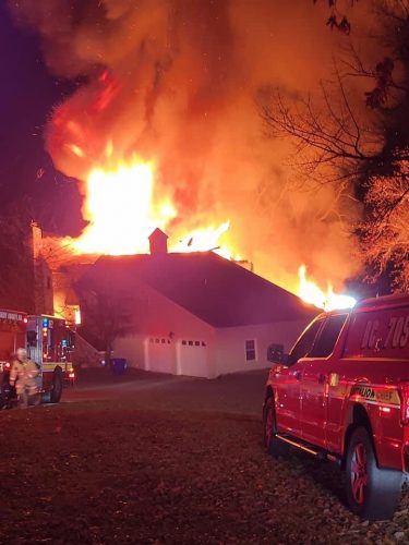
ICYMI (~10p 11/23) Big Woods Rd. Dickerson, house fire, non-hydrant area, @mcfrs arrived with a large 2/3-story single family house with heavy fire throughout structure & roof collapse, it is believed no one was home at time, No injuries reported, ~75 FFs on scene, Damage >$1M pic.twitter.com/6gmgDU7bPC
— Pete Piringer (@mcfrsPIO) November 24, 2021

