
It wouldn’t be the DMV without uncertainty about winter weather.
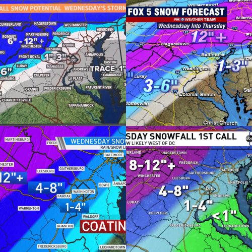
A winter storm watch was issued for the N/NW part of MoCo earlier this morning for the Wednesday storm. The major networks have released their second round of forecasted snow totals, but models are still all over the place.
Top left, WUSA9, is the most conservative of the bunch with this storm going with 1-3” for all of MoCo.
Fox5 has most of MoCo in the 3-6” range with the N/NW third of the county in the 6-12” range.
NBC4 has most of MoCo in the 4-8” range with the S/SE third of the county in the 1-4” range.
ABC7 has a range that is very similar to NBC4, with most of MoCo in the 4-8” range.
The models haven’t come together on a solution either.
The GFS has dropped its totals for MoCo to 2 inches for those closer to DC and up to 8 inches in parts of Upper MoCo.
The Euro is still showing high snow totals with a much wider range of 5 inches near DC and over a foot in parts of Upper MoCo.
We will continue to monitor this storm and see which direction it moves towards as we get within 48 hours.
Recent Stories
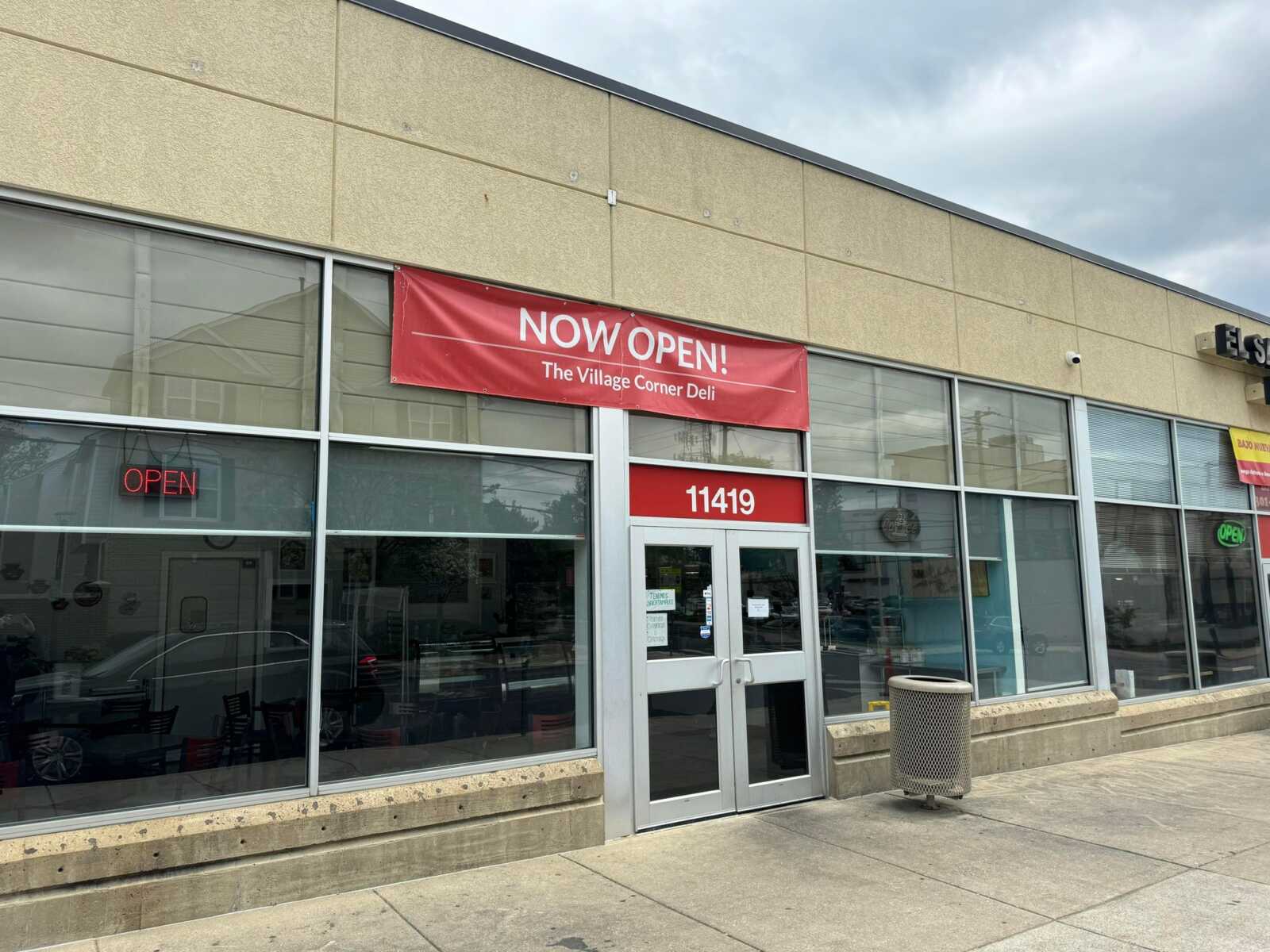
The Village Corner Deli is now open at 11419 Grandview Ave in Wheaton, next to El Sabor Latino Bakery.
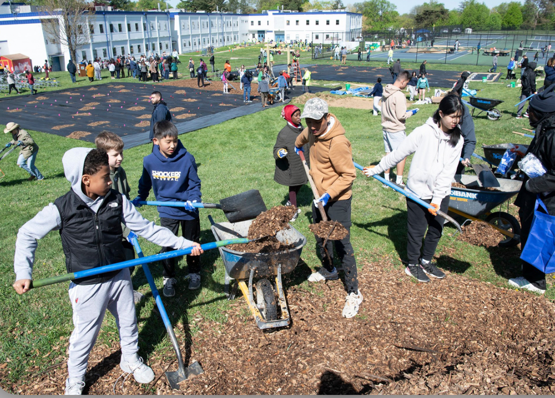
MCPS hosted nearly 1,000 volunteers, lawmakers and county leaders on April 22 for the Resilience, Education, Action, Climate, Habitat (REACH) Hub groundbreaking ceremony and Earth Day volunteer event at A. Mario Loiederman Middle…
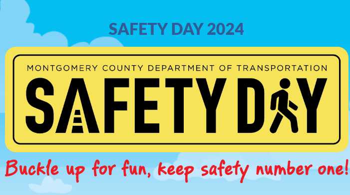
The Montgomery County Department of Transportation (MCDOT) has announced a free family-friendly event, “Community Safety Day,” led by local students. It’s set to take place from 11 am to 3…

MCPS is hosting this year’s Special Education Family Resource Fair on Saturday, May 11 at Montgomery Blair High School (51 University Blvd. East in Silver Spring). The free event will…
FEST OF SPRING Caribbean Wine Food & Music Festival

Get ready to experience the vibrant colors, tantalizing flavors, and infectious rhythms of the Caribbean at the FEST OF SPRING Caribbean Wine Food & Music Festival! Hosted by RHU LLC, this exciting festival is set to take place on May 18, 2024, at the picturesque 16700 Barnesville Rd in Boyds, MD.
Step into a world where the Caribbean spirit comes alive! From 12:00 PM onwards, immerse yourself in a sensory journey that celebrates the unique culture, cuisine, and music of the Caribbean. Whether you're an African American, a Reggae or Soca music enthusiast, a wine lover, or part of the vibrant Caribbean diaspora, this festival promises to delight and captivate you in every way.
Let the enticing aromas of mouthwatering Caribbean dishes tantalize your taste buds. Feast on traditional delicacies prepared by expert chefs, showcasing the rich and diverse culinary heritage of the Caribbean. Indulge in flavorful jerk chicken, succulent seafood, and delectable plantain dishes that will transport you straight to the islands.
Accompanying the culinary extravaganza is a carefully curated selection of premium wines, ensuring the perfect pairing for your palate. Sip on fine wines from renowned vineyards, each sip a reflection of the Caribbean's vibrant spirit. Discover new flavors, expand your wine knowledge, and savor unforgettable moments with every glass.
As the sun sets, get ready to groove to the infectious rhythms of Caribbean music. Feel the pulsating beats of reggae, soca, dancehall, and calypso, moving your body to the lively melodies. Live performances by talented musicians and performers will keep the energy high, ensuring a night of unforgettable entertainment.
Don't miss this opportunity to embrace the Caribbean spirit and celebrate the arrival of spring in style! Tickets are available on AllEvents, so secure your spot today. Join us at the FEST OF SPRING Caribbean Wine Food & Music Festival, where cultures collide and unforgettable memories are made.
LIVE PERFORMANCES By: CULTURE Feat. Kenyatta Hill, EXCO LEVI, IMAGE BAND, RAS LIDJ REGG'GO with Special Guest SUGAR BEAR FROM E.U. & MORE! & MORE!
MUSIC By: DJ ABLAZE, DJ SMALLY & NAJ SUPREME
2 NIGHT Camping packages available: RV/CAMPER $200 | TENTS $150 Starting on Friday May 17 @ 5pm | 30 RV SPACES | 30+ TENT SPACES
KIDS 12 & UNDER FREE!!!