
We’ve been watching the possibility of winter weather early on Thursday morning and there’s currently a possibility for a little ice in the early to mid-morning. Things have gone from possible snow to all rain to some ice, so there’s still a little time for this to get figured out before there’s any certainty behind what kind of event this will be.
This morning the GFS (American model) shows the surface low a little further east than it was last night, which means we could see a period of ice or snow early on Thursday before everything switches over to rain. If the low stays closer to the coast, as it looked like it would until this morning, then it would likely be too warm for us to see much/any winter precipitation.
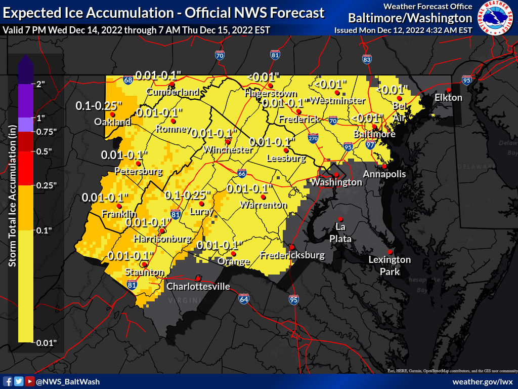
For the next couple days we will be watching where this will go. If the Euro (European model) run this afternoon looks more like this GFS run, then ice is certainly in play. As of now, it’s something to keep an eye on with the possibility of a little ice on Thursday morning. Featured photo shows the expected ice accumulation per the National Weather Service from 4:42am (prior to the most recent GFS run).
The tweet below is a graphic that shows the shift the latest GFS run shows:
INTERESTING TRENDS THIS MORNING..
New 6z GFS has nudged the surface low further S&E (see my prior tweets from yesterday why I believe that's correct). We are getting that snow line closer and closer to I-95. Helping out my friends at @phl17 this morning breaking it all down! pic.twitter.com/fQ4yQ8AzTE— Mike Masco (@MikeMasco) December 12, 2022