
National Weather Service Releases First Map for Potential Winter Weather on Thursday, 2/18
Yesterday’s model runs trended towards more snow for our area for both the GFS (American model) and the Euro (European model), but the overnight run of the Euro was a little drier.
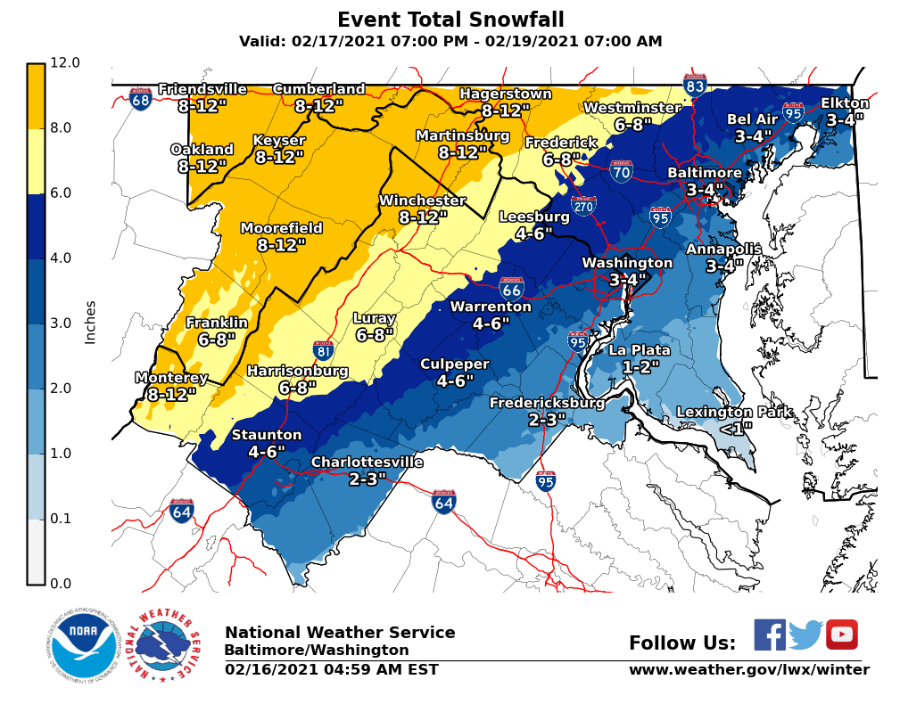
This morning/afternoon’s runs will be very telling when it comes to showing us if it’s a trend or a blip. If the Euro had stayed the course with the higher snow output, I suspect the first map from the NWS would’ve been about 2 inches higher for everyone.
As you can see in the map below, southern MoCo is in the 3-4″ range while upper MoCo is in the 4-6″ range.


There is also a threat of ice that comes with this storm, as mixing with sleet/freezing rain is a very real possibility.
We’ll continue to monitor this storm, but want to remind you of yesterday’s analogy. We scored early, but now the other team is starting to play a little better. We know how this usually goes for our team (our area), so we’re going to have to keep watching.
We’ll have an update for you later today.