
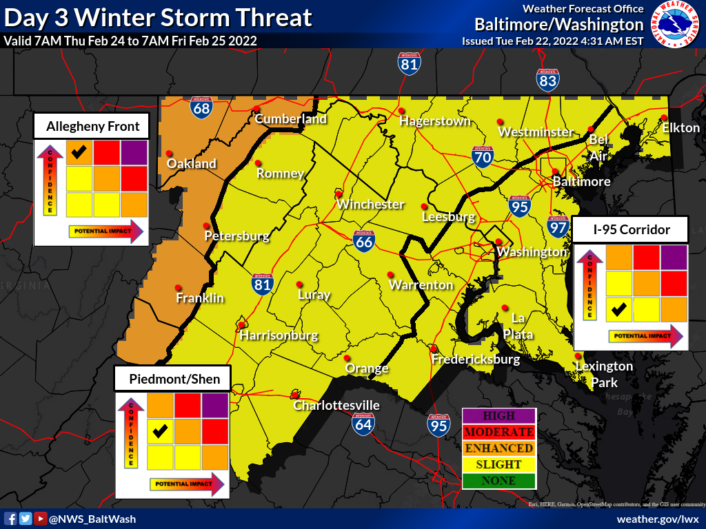
The National Weather Service has Montgomery County in the “Slight Winter Storm Threat” category for potential winter weather Thursday into Friday.
As of now, not much is expected for Montgomery County, with the threat of ice accumulation staying north for the most part. As you can see in the map below, some of the yellow goes into MoCo with Damascus possible having to deal with very light ice (one hundredth of an inch).

Some models have us getting a little bit ice while others have us getting nothing at all. It’s worth keeping an eye on, but not something to worry about yet.
Forecaster’s Discussion from the National Weather Service can be seen below:
The forecast becomes rather tricky in the details
advancing forward through Thursday as light precipitation
overspreads the area. There is not a strong models signal for
widespread subfreezing temperatures, however dew points will
drop into the teens/lower 20s behind the front. This sets the
stage for potential light wintry mix...possibly a bit of snow
and sleet at the start, but more of a freezing rain concern for
any areas that are below freezing (or end up there due to
wetbulb processes). The complex interaction between temperatures
and precipitation during this first round will set the stage
for additional freezing rain Thursday night as low pressure
approaches the Appalachians. The highest precipitation amounts
are currently forecast near and north of the Pennsylvania
border. This also happens to be where temperatures are most
likely to be near the freezing mark. The current forecast
acknowledges the potential for cold air damming to work in favor
of wintry precipitation in climatologically favored areas and
temperatures are below blended guidance. However, there could be
a more widespread light icing threat, at least for a time. Stay
tuned to the latest forecast.