Maryland Comptroller Brooke E. Lierman and Governor Wes Moore marked Unclaimed Property Day on Monday, February 1, 2026, encouraging residents to check whether the state was holding money or property in their name.

Maryland Comptroller Brooke E. Lierman and Governor Wes Moore marked Unclaimed Property Day on Monday, February 1, 2026, encouraging residents to check whether the state was holding money or property in their name.
Multiple large-scale illegal car rallies were dismantled Sunday night by the Maryland Car Rally Task Force and partner law enforcement agencies across Prince George’s, Anne Arundel, Montgomery, and Howard counties.

The Montgomery County Department of Transportation is hosting its annual “Heads Up, Phones Down” video contest, inviting Montgomery County high school students to create 30-second public service announcements encouraging people to stay alert and avoid phone use while driving or walking. (more…)

Montgomery County Public Schools remained closed Monday, February 2, citing ongoing safety concerns tied to snow and ice removal following last week’s winter weather. MCPS said cleanup has been slow, noting that Monday marks the first day temperatures are expected to rise above freezing after nine consecutive days below that mark.
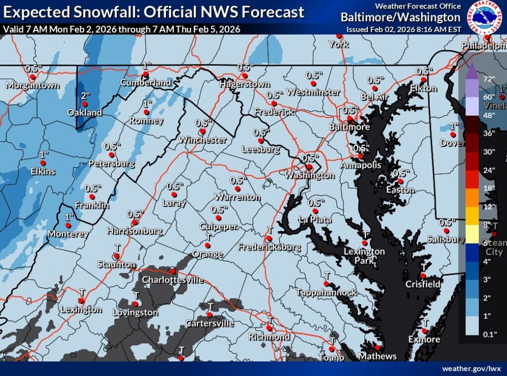
The National Weather Service (NWS) is expecting a light snowfall across much of Maryland and Northern Virginia Tuesday night into early Wednesday morning, with expected snowfall maps showing around half an inch of snow (a 10% chance of higher end totals can reach an inch, per the map below).

Maryland State Police arrested Rayshaud Davon Shield, 32, of Upper Marlboro, after a crash early Saturday morning in Prince George’s County that left a state trooper injured.
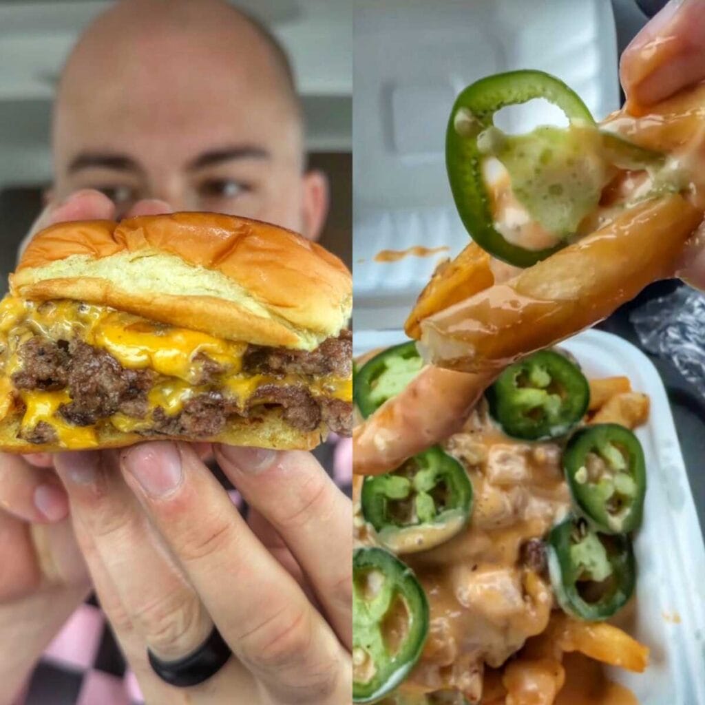
If you think you’ve had a great burger, wait until you meet this one. 7th Street Burger started as a smash-burger sensation in New York’s East Village, earned waves of praise and social-media buzz for its crispy, juicy patties and simple, craveable formula. That hype was brought to the DMV with its DC locations and now it’s here in Maryland with some calling it Maryland’s version of In-N-Out because of its fries.
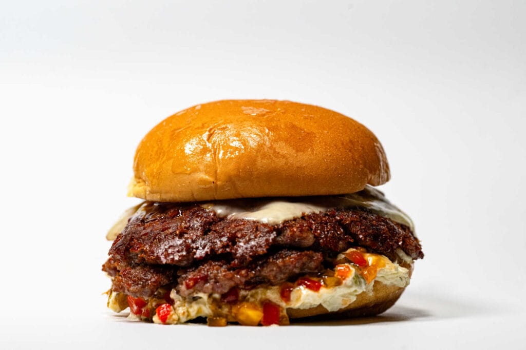
One of Maryland’s most talked-about burgers is entering its next chapter. Fifty Fifty, the Frederick-based burger concept known for its half beef, half bacon patties, is officially rebranding as Backslash Burger. While the name is changing, everything that made the burger a statewide standout is staying exactly the same.
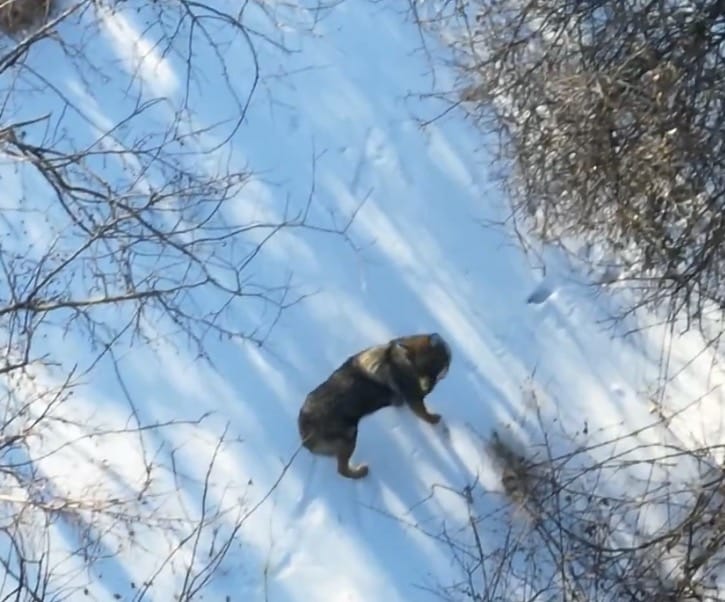
A pair of coywolves, also known as eastern coyotes, were spotted moving together Thursday afternoon in the Burtonsville area, according to Tim Pruss of MyDronePro, who encountered the animals while searching for a lost dog (video below).

Whether you love him or hate him, when Dave Portnoy gives a pizza a high score, people take notice. That’s exactly what happened with Frank’s Pizza & Pasta (6620 Belair Rd Baltimore, MD), a Baltimore-area staple known for its no-nonsense slices, stacked cheesesteaks, and classic Italian comfort food.
When the decision was made on Thursday to close schools for Friday, Jan. 30, Montgomery County Public Schools also shared early guidance about the start of the following week.