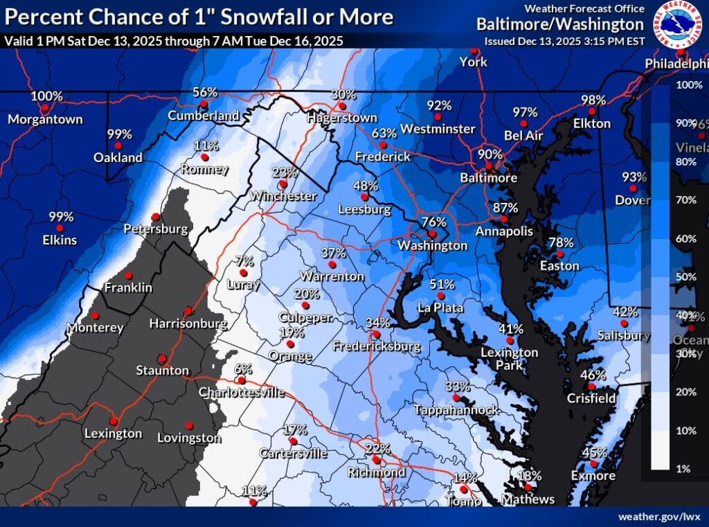
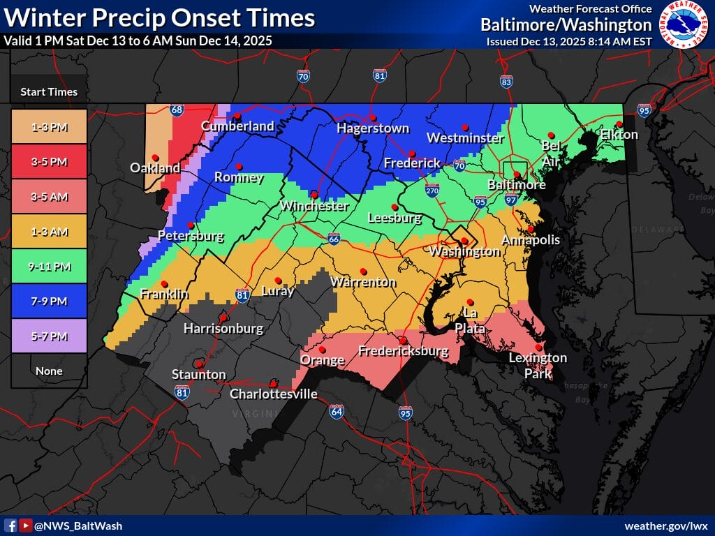
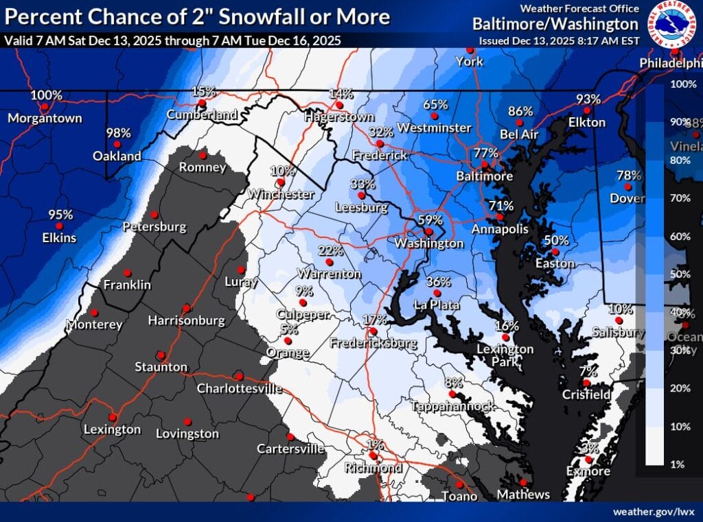
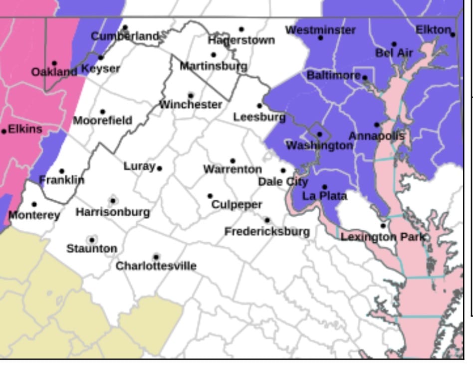
Snow totals across the DC region are trending higher Saturday night, with updated forecasts from NBC4 Chief Meteorologist Doug Kammerer and the National Weather Service showing increased confidence in measurable accumulation for much of Montgomery County and the surrounding area.

Both sets of maps point to a narrow but impactful band of snow developing late Saturday night and continuing into early Sunday morning. While widespread totals of 1 to 3 inches remain the most likely outcome for central Maryland and the District, newer guidance shows pockets where higher amounts are possible if the heavier band sets up overhead.


The National Weather Service has extended the Winter Weather Advisory for parts of Maryland through 10 am Sunday, as forecasters continue to monitor a narrow but potentially impactful band of overnight snow.

(more…)


A Winter Weather Advisory is now in effect for the District of Columbia and much of central and northern Maryland, including Montgomery County, as well as parts of northern Virginia, with snow expected overnight into early Sunday morning.

(more…)


A fast-moving winter system is expected to bring a narrow but, potentially intense band of snow to parts of Maryland, including the DC and Baltimore metro areas, late Saturday night into early Sunday morning. The National Weather Service warns that totals will vary sharply depending on where that band ultimately sets up.

(more…)


Several of the region’s major TV weather teams are starting to roll out early snowfall maps for a system expected to move through the DMV area late Saturday night into early Sunday morning. Some are from last night and others are from this morning, with all likely to be refined throughout today and tomorrow.

(more…)


The National Weather Service is tracking a system that could bring accumulating snow to the region early Sunday morning, with most of Maryland and Northern Virginia currently forecast to receive around 2 inches. Updated snowfall projections show a wide range of possibilities depending on how quickly temperatures drop and how the heaviest band sets up.

(more…)


The National Weather Service (NWS) has issued its first set of graphics for this weekend’s winter storm, highlighting an elevated risk for accumulating snow across much of Maryland, including most of Montgomery County. The storm is expected to arrive Saturday night into Sunday morning, with the potential for lingering impacts into Monday due to very cold temperatures.

(more…)


The DC region is watching two separate snow chances over the next several days, beginning with a weak system on Friday and followed by a more organized threat Saturday night into Sunday. While confidence remains low for exact totals, meteorologists agree that the second storm has the better potential to bring accumulating snow to parts of Maryland, including Montgomery County.

(more…)


View More Stories