
The National Weather Service has released a map for the potential of snow on Thursday night into Friday morning.
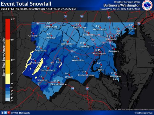
Per the map, 2-3” of snow is expected for central and upper MoCo while 3-4” is expected for southern MoCo (Bethesda/Silver Spring).
Many weather apps are showing a 3-6” total, and while it’s a possibility it isn’t necessarily the right outlook at of now (Wednesday morning).
Fox 5 has released a map showing 1-3” for all of MoCo.
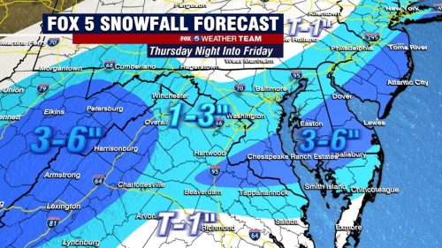
While less snow is expected than the early-week Storm, the ground will be much colder to start so snow is more likely to stick earlier on. The timing of this one will likely cause problems for the morning commute.
As always, things can definitely change. Stay tuned!
Recent Stories

On May 10, 2024, shortly after 5:00 p.m., the Rockville City Police Department responded to a report of a stabbing in the 300 block of N. Washington Street. Upon arrival,…

The Maryland Department of Transportation (MDOT) State Highway Administration (SHA) has released its major lane closures for this weekend. They can be seen below, by county:

Montgomery County Executive Marc Elrich has sent his weekly message to the community. It can be seen below:
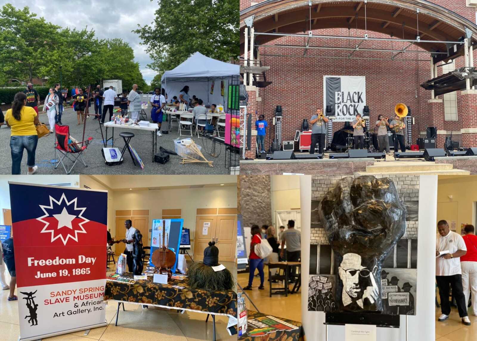
Montgomery County is seeking nominations for the African American Living Legends Awards to be presented at its annual Juneteenth Celebration.
FREE Shred Day

Join us at Lafayette Federal Credit Union for a Free Community Shred Day, an event dedicated to helping you protect your privacy and the environment! Bring your old bank statements, bills, medical records, and any other paper documents that need secure disposal, and we'll take care of them on the spot.
Why You Should Come:
Protect Your Privacy: Safely shred sensitive documents to help prevent identity theft.
Eco-Friendly: All shredded material will be recycled, supporting our commitment to sustainability.
Complimentary Breakfast: Enjoy a free breakfast on us--start your day right with good food and good company!
Exciting Giveaways & Prizes: Don't miss out on giveaways and be sure to enter our drawing for a chance to win one of four $100 gift cards.
This event is open to all! It's a fantastic opportunity to clean out those old documents cluttering up your home, safe in the knowledge that they will be disposed of securely. Plus, it's completely free!
Don't miss out on this chance to declutter safely, enjoy some free treats, and possibly win a great prize. We look forward to seeing you there, rain or shine!
For more information, contact us at www.lfcu.events/shred.
FEST OF SPRING Caribbean Wine Food & Music Festival

Get ready to experience the vibrant colors, tantalizing flavors, and infectious rhythms of the Caribbean at the FEST OF SPRING Caribbean Wine Food & Music Festival! Hosted by RHU LLC, this exciting festival is set to take place on May 18, 2024, at the picturesque 16700 Barnesville Rd in Boyds, MD.
Step into a world where the Caribbean spirit comes alive! From 12:00 PM onwards, immerse yourself in a sensory journey that celebrates the unique culture, cuisine, and music of the Caribbean. Whether you're an African American, a Reggae or Soca music enthusiast, a wine lover, or part of the vibrant Caribbean diaspora, this festival promises to delight and captivate you in every way.
Let the enticing aromas of mouthwatering Caribbean dishes tantalize your taste buds. Feast on traditional delicacies prepared by expert chefs, showcasing the rich and diverse culinary heritage of the Caribbean. Indulge in flavorful jerk chicken, succulent seafood, and delectable plantain dishes that will transport you straight to the islands.
Accompanying the culinary extravaganza is a carefully curated selection of premium wines, ensuring the perfect pairing for your palate. Sip on fine wines from renowned vineyards, each sip a reflection of the Caribbean's vibrant spirit. Discover new flavors, expand your wine knowledge, and savor unforgettable moments with every glass.
As the sun sets, get ready to groove to the infectious rhythms of Caribbean music. Feel the pulsating beats of reggae, soca, dancehall, and calypso, moving your body to the lively melodies. Live performances by talented musicians and performers will keep the energy high, ensuring a night of unforgettable entertainment.
Don't miss this opportunity to embrace the Caribbean spirit and celebrate the arrival of spring in style! Tickets are available on AllEvents, so secure your spot today. Join us at the FEST OF SPRING Caribbean Wine Food & Music Festival, where cultures collide and unforgettable memories are made.
LIVE PERFORMANCES By: CULTURE Feat. Kenyatta Hill, EXCO LEVI, IMAGE BAND, RAS LIDJ REGG'GO with Special Guest SUGAR BEAR FROM E.U. & MORE! & MORE!
MUSIC By: DJ ABLAZE, DJ SMALLY & NAJ SUPREME
2 NIGHT Camping packages available: RV/CAMPER $200 | TENTS $150 Starting on Friday May 17 @ 5pm | 30 RV SPACES | 30+ TENT SPACES
KIDS 12 & UNDER FREE!!!