
A Winter Weather Advisory remains in effect for MoCo, until 7am in Central and Southeast MoCo and until 10am in Northwest MoCo.
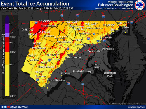
The advisory is calling for about a tenth of an inch of ice for Northwest MoCo and up to a tenth of an inch for Central and Southeast MoCo.
Currently temperatures are hovering around the freezing mark with some freezing drizzle/rain falling, which could make for slick conditions, but as you see in the tweet below from the National Weather Service, temperatures should slowly rise above freezing overnight.
Temperatures are expected to remain steady or slowly rise tonight as low pressure approaches from the west and winds turn more southeasterly. Steadier, heavier rain (freezing rain at higher elevations) is expected to overspread the area later this evening. pic.twitter.com/75yCF4CBMy
— NWS Baltimore-Washington (@NWS_BaltWash) February 25, 2022
By the time the morning commute gets started, most roads should just be wet, but there could still be some slick areas the further north you go.
The most recent map from the NWS is from 5:09pm today and is pretty similar to the maps from the last 24 hours showing very light ice across the board for MoCo.
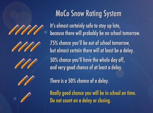
 Pencil Prediction for Friday, 2/25/22: 1.5 Pencils
While there’s a chance temperatures stay at or below freezing and things are a lot slicker than expected during the morning commute, right now it doesn’t look very likely.
Recent Stories

The Dentzel Carousel at Glen Echo Park will be reopening this Saturday, April 27 for its 103rd season. To celebrate, Glen Echo Park is hosting “Carousel Day” from 11am-4pm.
Montgomery County Police responded to a report of shots fired at approximately 8:56pm on Friday, April 26 in Montgomery Village.

Today in the Circuit Court for Montgomery County, MD, judge Jeanne Cho sentenced defendant, Tyrone Curtis, to life in prison suspend all but 15 years and five years of supervised…
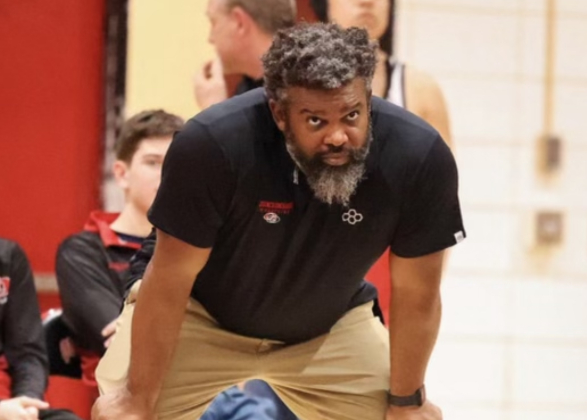
The Quince Orchard Athletic Department has announced the hiring of Richard Tyler Jr. as its new Head Varsity Wrestling Coach. Rich Tyler is an accomplished athlete and coach with a distinguished…
FEST OF SPRING Caribbean Wine Food & Music Festival

Get ready to experience the vibrant colors, tantalizing flavors, and infectious rhythms of the Caribbean at the FEST OF SPRING Caribbean Wine Food & Music Festival! Hosted by RHU LLC, this exciting festival is set to take place on May 18, 2024, at the picturesque 16700 Barnesville Rd in Boyds, MD.
Step into a world where the Caribbean spirit comes alive! From 12:00 PM onwards, immerse yourself in a sensory journey that celebrates the unique culture, cuisine, and music of the Caribbean. Whether you're an African American, a Reggae or Soca music enthusiast, a wine lover, or part of the vibrant Caribbean diaspora, this festival promises to delight and captivate you in every way.
Let the enticing aromas of mouthwatering Caribbean dishes tantalize your taste buds. Feast on traditional delicacies prepared by expert chefs, showcasing the rich and diverse culinary heritage of the Caribbean. Indulge in flavorful jerk chicken, succulent seafood, and delectable plantain dishes that will transport you straight to the islands.
Accompanying the culinary extravaganza is a carefully curated selection of premium wines, ensuring the perfect pairing for your palate. Sip on fine wines from renowned vineyards, each sip a reflection of the Caribbean's vibrant spirit. Discover new flavors, expand your wine knowledge, and savor unforgettable moments with every glass.
As the sun sets, get ready to groove to the infectious rhythms of Caribbean music. Feel the pulsating beats of reggae, soca, dancehall, and calypso, moving your body to the lively melodies. Live performances by talented musicians and performers will keep the energy high, ensuring a night of unforgettable entertainment.
Don't miss this opportunity to embrace the Caribbean spirit and celebrate the arrival of spring in style! Tickets are available on AllEvents, so secure your spot today. Join us at the FEST OF SPRING Caribbean Wine Food & Music Festival, where cultures collide and unforgettable memories are made.
LIVE PERFORMANCES By: CULTURE Feat. Kenyatta Hill, EXCO LEVI, IMAGE BAND, RAS LIDJ REGG'GO with Special Guest SUGAR BEAR FROM E.U. & MORE! & MORE!
MUSIC By: DJ ABLAZE, DJ SMALLY & NAJ SUPREME
2 NIGHT Camping packages available: RV/CAMPER $200 | TENTS $150 Starting on Friday May 17 @ 5pm | 30 RV SPACES | 30+ TENT SPACES
KIDS 12 & UNDER FREE!!!