
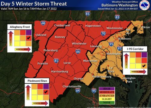
The National Weather Service has increased the risk for Sunday’s potential winter storm to moderate for Upper MoCo and enhanced for C/SE MoCo. Per their map in our featured photo, the confidence for the winter storm has also increased to moderate for upper MoCo and enhanced for C/SE MoCo.
We have to remember that we’re discussing a storm that hasn’t even formed yet, so a lot can change. To help people understand, I always compare tracking a storm to the score of the game when your favorite team is upsetting the best team in the league. When we’re five days out, it’s early in the first quarter. Each model shows you a different aspect or perspective of the game. You can be happy with what’s happening from one or all perspectives, but you know there’s a good chance it won’t end up that way.
The Euro (European model) is showing the snow/rain line running right through the lower part of MoCo. The GFS (American model) is now showing a much higher chance of rain. This is all dependent on where the low is for this storm and will likely change quite a few times as Sunday approaches.
This winter we are a surprising 2 for 2 when it comes to winter storms developing in a way that gives us measurable snow. We’ll continue to monitor to see if our luck continues or runs out with this one.
Below you’ll see the Forecaster’s discussion from the National Weather Service:
“Saturday will be the “calm before the storm” during the long term period across our region. A strong 1040+ mb artic high will be building to our north, setting the stage for much colder air. Highs will likely not make it above freezing for most on Saturday, but we should be dry during this period.
Elsewhere on Saturday, a winter storm will be brewing over the central Plains and into the southeast. The first key feature will be a very strong Alberta Clipper system that dives out of Canada through the central Plains and into the southeast by Saturday night. The upper low looks to cut off over the southeast Saturday night.
Meanwhile, probably the most important piece of the puzzle will be another upper low diving out of central Canada into the Great Lakes region Sunday through Monday morning. For our area, this sets the stage for a potentially high impact winter storm across the region. Surface low pressure will slide across the southeast before transferring energy off the east coast into Sunday night.
As is so often the case with these storms, the track, as well as warm air aloft, are going to be key in who gets an all snow event versus who gets a wintry mix and who may even just get a plain cold rain.
Guidance is starting to come into at least some agreement that areas west of the I-95 corridor could be in for a high impact winter storm, while the I-95 corridor and areas east still hold some uncertainty.
Virtually all guidance at this point is at least agreeing on a strong low moving up the eastern seaboard, it is just a matter of how close it tracks to the coast. Again, as is often the case, 20 miles can make all the difference. Those details will have to be ironed out as we continue to move closer to the event.
For now, just be prepared for a potentially high impact winter storm across the area, and check weather.gov/lwx/winter for more updates on the forecast as we get closer to the event.
One minor change on this cycle is that the guidance seems to be speeding up in terms of when the low departs. By Monday morning most of the precipitation should be off to our northeast. High pressure then briefly returns through Tuesday, with highs expected to be near seasonal averages.”
Recent Stories
The Maryland State Police have released information regarding its participation in this Saturday’s National Drug Take Back Day.

Transportation Security Administration (TSA) officers have announced that it had intercepted its sixth gun at a security checkpoint so far this month.
Mayor Jud Ashman and members of the City Council hosted the 2024 State of the City address on Thursday, April 18, at Asbury Methodist Village.
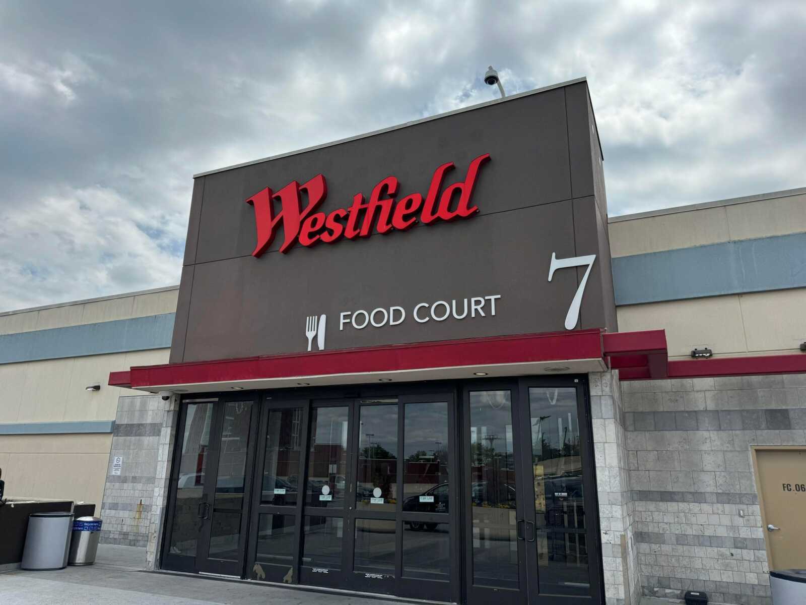
Below is a list of businesses that have recently opened, closed, or are coming soon to Wheaton Mall at 11160 Veirs Mill Rd.
FEST OF SPRING Caribbean Wine Food & Music Festival

Get ready to experience the vibrant colors, tantalizing flavors, and infectious rhythms of the Caribbean at the FEST OF SPRING Caribbean Wine Food & Music Festival! Hosted by RHU LLC, this exciting festival is set to take place on May 18, 2024, at the picturesque 16700 Barnesville Rd in Boyds, MD.
Step into a world where the Caribbean spirit comes alive! From 12:00 PM onwards, immerse yourself in a sensory journey that celebrates the unique culture, cuisine, and music of the Caribbean. Whether you're an African American, a Reggae or Soca music enthusiast, a wine lover, or part of the vibrant Caribbean diaspora, this festival promises to delight and captivate you in every way.
Let the enticing aromas of mouthwatering Caribbean dishes tantalize your taste buds. Feast on traditional delicacies prepared by expert chefs, showcasing the rich and diverse culinary heritage of the Caribbean. Indulge in flavorful jerk chicken, succulent seafood, and delectable plantain dishes that will transport you straight to the islands.
Accompanying the culinary extravaganza is a carefully curated selection of premium wines, ensuring the perfect pairing for your palate. Sip on fine wines from renowned vineyards, each sip a reflection of the Caribbean's vibrant spirit. Discover new flavors, expand your wine knowledge, and savor unforgettable moments with every glass.
As the sun sets, get ready to groove to the infectious rhythms of Caribbean music. Feel the pulsating beats of reggae, soca, dancehall, and calypso, moving your body to the lively melodies. Live performances by talented musicians and performers will keep the energy high, ensuring a night of unforgettable entertainment.
Don't miss this opportunity to embrace the Caribbean spirit and celebrate the arrival of spring in style! Tickets are available on AllEvents, so secure your spot today. Join us at the FEST OF SPRING Caribbean Wine Food & Music Festival, where cultures collide and unforgettable memories are made.
LIVE PERFORMANCES By: CULTURE Feat. Kenyatta Hill, EXCO LEVI, IMAGE BAND, RAS LIDJ REGG'GO with Special Guest SUGAR BEAR FROM E.U. & MORE! & MORE!
MUSIC By: DJ ABLAZE, DJ SMALLY & NAJ SUPREME
2 NIGHT Camping packages available: RV/CAMPER $200 | TENTS $150 Starting on Friday May 17 @ 5pm | 30 RV SPACES | 30+ TENT SPACES
KIDS 12 & UNDER FREE!!!